12 Best Drone Flight Planning App Options for 2025
- Paul Simmons

- Jul 26, 2025
- 16 min read
Updated: Jul 28, 2025
In 2025, a drone is only as powerful as the software that guides it. Manual control has its limits, especially for complex missions like precision agriculture, cinematic videography, or critical infrastructure inspections. These advanced operations demand automated precision, safety, and efficiency, which is precisely where a dedicated drone flight planning app becomes your most essential tool. This software is not just about plotting a simple path; it is about unlocking your UAV's full potential through intelligent flight automation, real-time airspace awareness, and data-centric mission execution.
Choosing the right application is critical. For a commercial pilot managing a fleet, it ensures compliance and operational consistency. For a hobbyist or photographer, it guarantees the perfect, repeatable shot every time. The wrong choice can lead to grounded equipment, while the right one transforms a good flight into a flawless, professional operation.
This guide cuts through the noise of the crowded app market. We will analyze the 12 best drone flight planning app options available today, from mainstream solutions like DroneDeploy and Litchi to open-source powerhouses like Mission Planner. We'll detail their key features, pricing, and ideal use cases to help you find the perfect fit for your specific needs, ensuring every launch is safe, compliant, and perfectly executed.
1. DroneDeploy
DroneDeploy stands as the industry leader in enterprise-grade drone software, positioning itself as a comprehensive reality capture platform rather than just a simple flight planning tool. It excels in converting job sites into detailed digital twins, making it an indispensable asset for large-scale operations in construction, agriculture, and energy. Its automated flight planning is robust, allowing users to create complex missions for mapping, inspections, and progress tracking with just a few clicks.
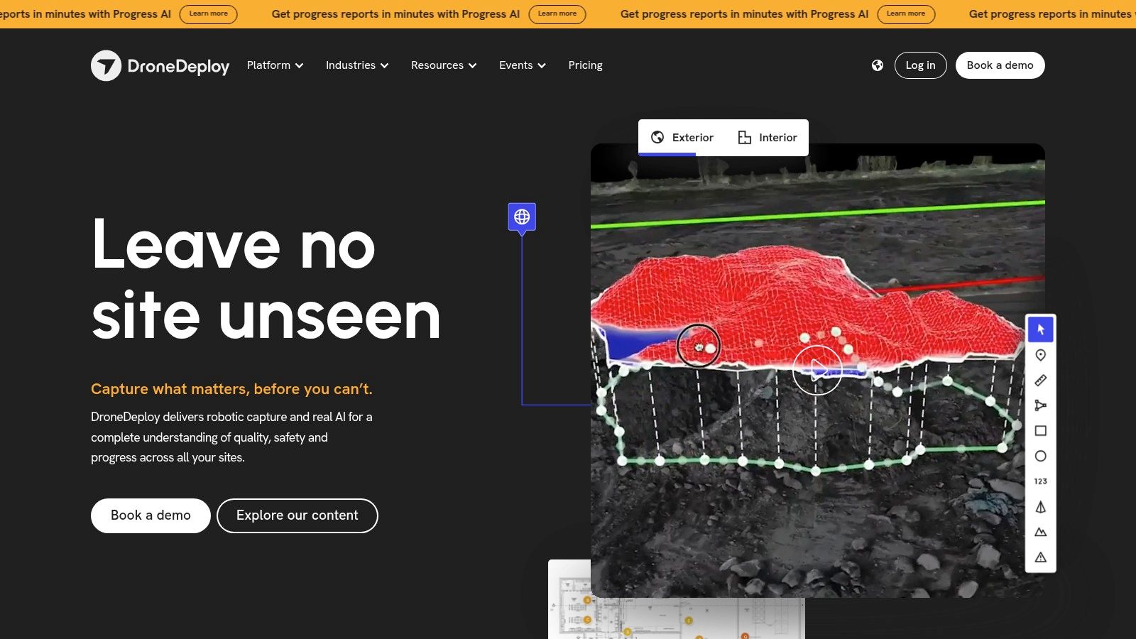
What truly sets DroneDeploy apart is its powerful cloud-based processing and AI-driven analytics. After a flight, the platform automatically processes the captured data to generate high-resolution maps, 3D models, and insightful reports. For instance, a construction manager can use it to measure stockpile volumes accurately, while an agronomist can analyze crop health using its specialized plant health algorithms. The user interface is exceptionally polished and intuitive, simplifying what could otherwise be a very complex process.
Key Details & Use Cases
Best For: Professional and enterprise users in construction, agriculture, surveying, and energy sectors.
Pricing: Subscription-based. Plans like "Air" start around $329/month (billed annually), with more advanced "Enterprise" plans requiring a custom quote. A free trial is available to test core features.
Key Feature: The platform’s ability to process massive datasets in the cloud and deliver actionable insights through AI-powered analysis is its standout feature.
Limitation: The high cost of its subscription model makes it prohibitive for hobbyists or small-scale commercial operators. A consistent internet connection is also necessary for real-time mapping and data syncing.
Website: https://www.dronedeploy.com
2. Litchi
Litchi is celebrated among DJI drone pilots as the go-to third-party drone flight planning app for unlocking advanced creative possibilities. While the standard DJI app is functional, Litchi empowers users with sophisticated autonomous flight modes like Waypoint, Orbit, and Follow, which are perfect for capturing cinematic shots that would be difficult to achieve manually. Its ability to pre-plan intricate missions on a desktop computer via the Mission Hub and then seamlessly sync them to a mobile device is a major advantage for creators who value meticulous preparation.
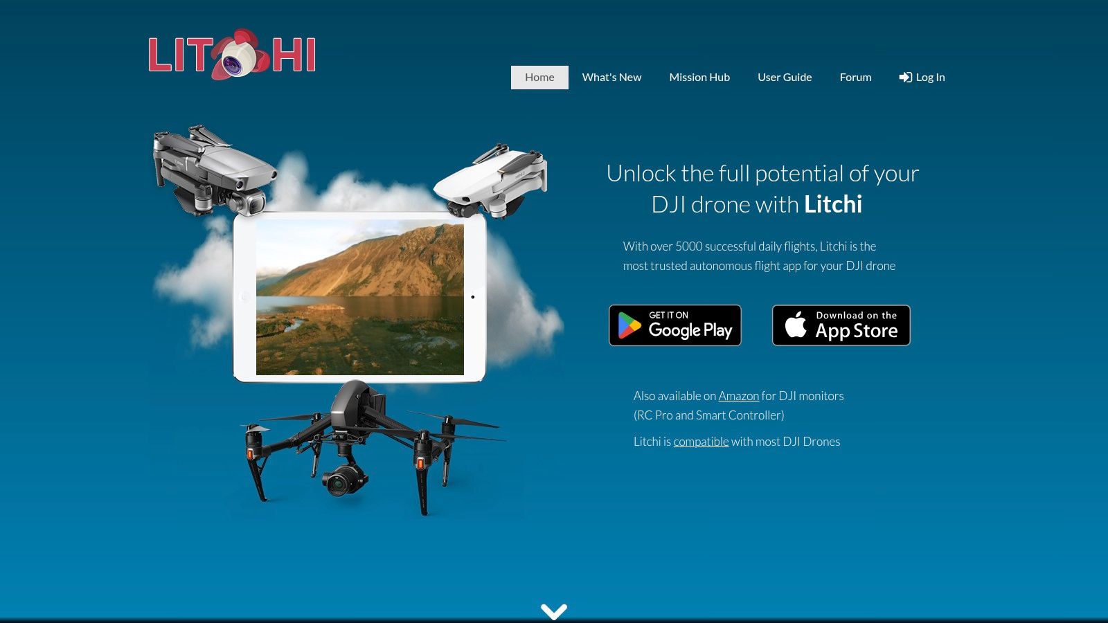
What truly makes Litchi stand out for creative pilots is its VR/FPV mode, which provides an immersive first-person view by connecting a VR headset to your phone. This feature transforms a standard DJI drone into a more engaging flying experience, bridging the gap between stabilized camera drones and dedicated FPV models. The user interface is clean and accessible, making complex flight patterns easy to set up. Its one-time purchase model also offers incredible long-term value compared to subscription-based alternatives, making it a favorite for both serious hobbyists and professional videographers. For those interested in this style of flying, you can explore the best FPV drones of 2025 for more options.
Key Details & Use Cases
Best For: Creative photographers, videographers, and drone enthusiasts using DJI aircraft.
Pricing: A one-time purchase of around $25, which varies slightly between the iOS App Store and Google Play Store. The Mission Hub is free to use for planning.
Key Feature: The combination of its powerful web-based Mission Hub for pre-flight planning and the immersive in-flight VR/FPV mode.
Limitation: The app is exclusively for DJI drones, so it won't work with other brands. Additionally, compatibility can vary, with some newer DJI models or firmware updates experiencing delays in support for all features.
Website: https://flylitchi.com
3. DroneDeploy
DroneDeploy stands as the industry leader in enterprise-grade drone software, positioning itself as a comprehensive reality capture platform rather than just a simple flight planning tool. It excels in converting job sites into detailed digital twins, making it an indispensable asset for large-scale operations in construction, agriculture, and energy. Its automated flight planning is robust, allowing users to create complex missions for mapping, inspections, and progress tracking with just a few clicks.
What truly sets DroneDeploy apart is its powerful cloud-based processing and AI-driven analytics. After a flight, the platform automatically processes the captured data to generate high-resolution maps, 3D models, and insightful reports. For instance, a construction manager can use it to measure stockpile volumes accurately, while an agronomist can analyze crop health using its specialized plant health algorithms. The user interface is exceptionally polished and intuitive, simplifying what could otherwise be a very complex process.
Key Details & Use Cases
Best For: Professional and enterprise users in construction, agriculture, surveying, and energy sectors.
Pricing: Subscription-based. Plans like "Air" start around $329/month (billed annually), with more advanced "Enterprise" plans requiring a custom quote. A free trial is available to test core features.
Key Feature: The platform’s ability to process massive datasets in the cloud and deliver actionable insights through AI-powered analysis is its standout feature.
Limitation: The high cost of its subscription model makes it prohibitive for hobbyists or small-scale commercial operators. A consistent internet connection is also necessary for real-time mapping and data syncing.
Website: https://www.dronedeploy.com
4. Pix4Dcapture
Pix4Dcapture is a dedicated flight planning app designed specifically for creating optimal data sets for photogrammetry. While many apps include mapping as a feature, Pix4Dcapture is purpose-built for it, offering automated flight missions that ensure consistent overlap and image quality necessary for high-quality 3D models and maps. This focus makes it a preferred drone flight planning app for professionals who rely on the Pix4D ecosystem for data processing.
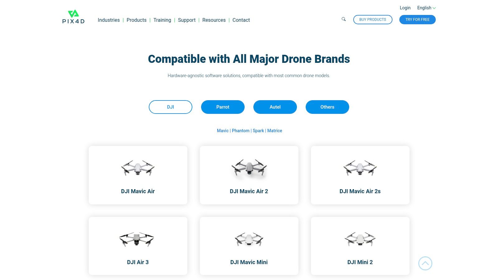
The app’s main advantage is its seamless integration with Pix4D's powerful suite of processing software like PIX4Dmapper and PIX4Dcloud. It offers multiple flight templates, including grid, double grid, and circular missions, allowing users to capture comprehensive data for both horizontal and vertical structures. Pilots can plan missions offline and adjust parameters like flight altitude, camera angle, and image overlap on-site, providing essential flexibility in the field. To better understand how it fits into a larger workflow, you can explore its role in drone mapping software guides.
Key Details & Use Cases
Best For: Surveyors, engineers, and mappers who are already invested in or planning to use the Pix4D software ecosystem.
Pricing: The Pix4Dcapture app itself is free to download and use. However, its true value is unlocked when paired with Pix4D's paid processing software licenses.
Key Feature: Its primary strength is the specialized flight plans (e.g., Double Grid, Circular) optimized specifically for photogrammetric data acquisition.
Limitation: The app's core purpose is data collection for Pix4D software. While it functions well as a flight planner, users not utilizing Pix4D for processing might find it less versatile than other all-in-one solutions.
5. AirMap
AirMap has carved out a critical niche in the drone ecosystem, focusing primarily on airspace intelligence and situational awareness. Rather than competing on complex 3D modeling, it positions itself as an essential safety and compliance tool. This drone flight planning app provides pilots with real-time, geolocated airspace maps, showing no-fly zones, temporary flight restrictions (TFRs), and controlled airspace with remarkable clarity. Its primary function is to help pilots understand where it is safe and legal to fly, preventing accidental incursions into restricted areas.
What makes AirMap indispensable for many pilots is its integration with aviation authorities, enabling features like digital Low Altitude Authorization and Notification Capability (LAANC) requests directly from the app in supported regions. This streamlines the process of getting permission to fly in controlled airspace, which is a major hurdle for commercial and recreational pilots alike. The user interface is clean and map-centric, prioritizing the immediate delivery of critical airspace data over complex mission planning tools, making it a go-to for pre-flight safety checks.
Key Details & Use Cases
Best For: All pilots, from hobbyists to commercial operators, who need to ensure regulatory compliance and flight safety, especially when operating near airports or in urban areas.
Pricing: Core airspace awareness features are free. Advanced services for developers and enterprise partners are available through custom plans.
Key Feature: The ability to submit digital LAANC requests for authorization to fly in U.S. controlled airspace is its most valuable feature, saving pilots significant time and effort.
Limitation: While excellent for airspace awareness, it is not a comprehensive mission planner for autonomous mapping or complex photogrammetry flights. Its functionality can also vary significantly based on regional aviation authority support.
Website: https://www.airmap.com
6. Aloft (formerly Kittyhawk)
Aloft, formerly known as Kittyhawk, is a comprehensive drone operations platform that masterfully blends robust flight planning with critical airspace safety and compliance. It has established itself as a go-to solution for pilots who need more than just a route planner, offering a suite of tools for pre-flight checks, in-flight monitoring, and post-flight logging. Its core strength lies in its deep integration with the FAA, providing pilots with instant, reliable LAANC authorizations directly within the app, which is a major time-saver for commercial operations in controlled airspace.
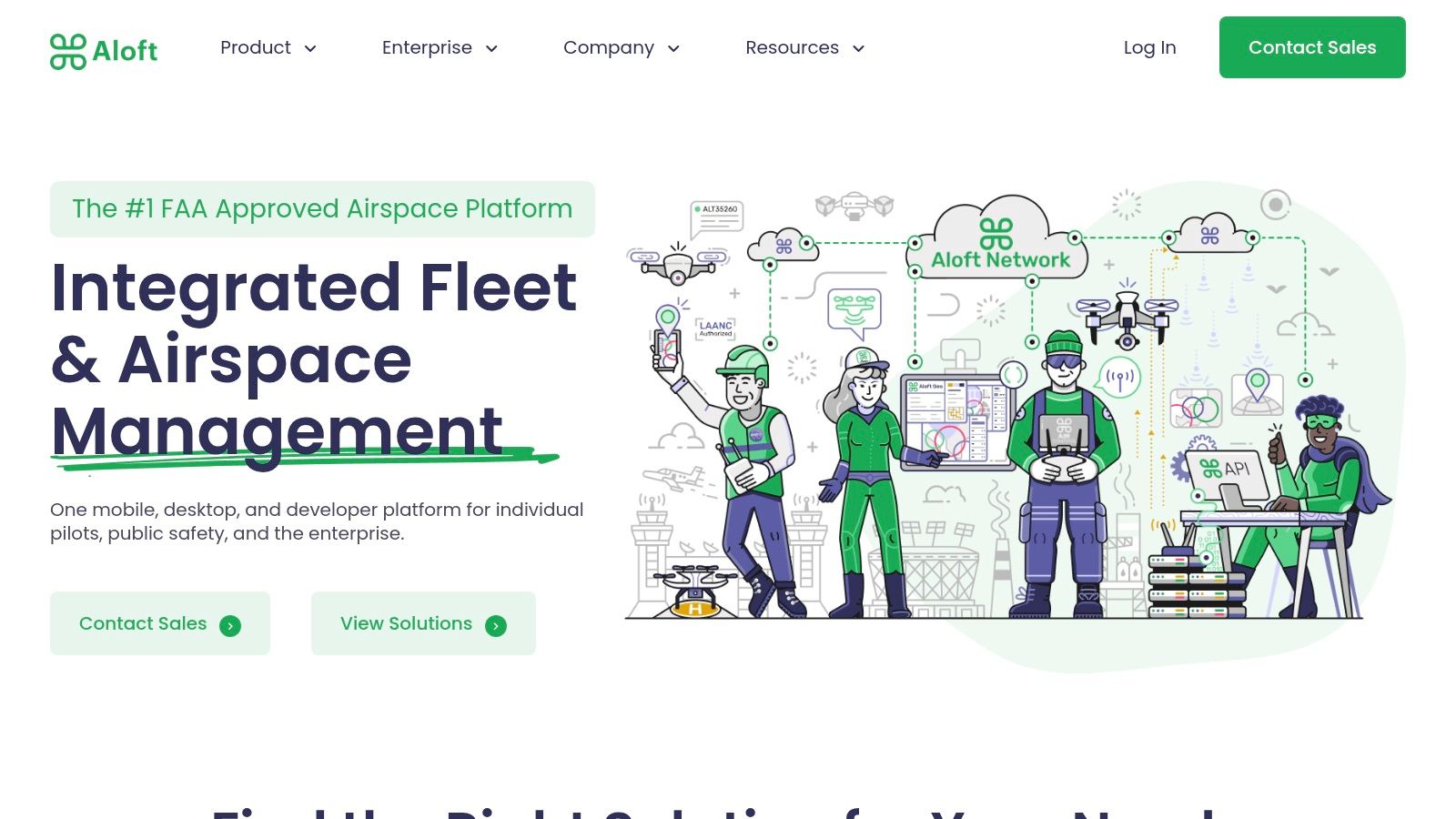
What makes Aloft a standout drone flight planning app is its focus on the complete operational lifecycle. The platform includes risk assessment checklists, secure document storage, and detailed flight logging, which are essential for maintaining compliance records. The user interface is clean and accessible, making it easy for both new and experienced pilots to navigate complex airspace data. For teams, its fleet management capabilities provide a centralized hub to oversee pilots, aircraft, and batteries, which you can read more about in this guide to drone fleet management software.
Key Details & Use Cases
Best For: Commercial pilots and organizations needing an all-in-one compliance, flight planning, and fleet management tool. Also great for hobbyists who want reliable airspace intelligence.
Pricing: A robust "Air Control" plan is available for free, covering most individual pilot needs. Paid plans like "Enterprise" are available with custom pricing for advanced team and fleet features.
Key Feature: The seamless, in-app Low Altitude Authorization and Notification Capability (LAANC) for receiving automated FAA airspace authorization is its most powerful and distinguishing feature.
Limitation: While the free version is generous, accessing the full suite of advanced fleet management and security features requires a paid enterprise subscription, which may be overkill for solo operators.
Website: https://www.aloft.ai
7. Dronedesk
Dronedesk positions itself as an all-in-one drone operations management platform, designed to significantly cut down on administrative overhead. It moves beyond simple flight planning by integrating every aspect of a job, from initial client quotes to post-flight logging and invoicing. This end-to-end workflow is its core strength, aiming to reduce the time spent on pre-flight paperwork and compliance checks by over 50%, making it a powerful drone flight planning app for busy professionals.
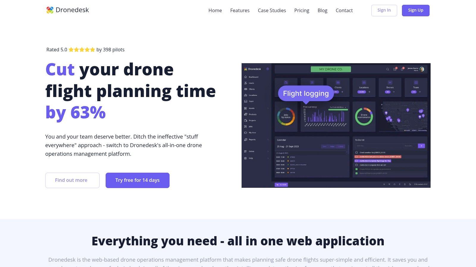
What makes Dronedesk particularly effective is its highly intuitive interface that consolidates flight planning, risk assessments, airspace intelligence, and asset management into a single, cohesive dashboard. It automates much of the tedious documentation required for commercial operations, generating detailed flight plans and reports compliant with aviation authority standards. This focus on business management and operational efficiency makes it ideal for sole operators or small drone businesses looking to professionalize and scale their services without getting bogged down by paperwork.
Key Details & Use Cases
Best For: Freelance commercial drone operators and small drone service businesses needing a streamlined business and compliance management tool.
Pricing: Offers scalable monthly subscriptions. The "Hobbyist" plan is free, "Pro" starts around £20/month, and "Team" plans are available for larger operations. A free trial is offered for paid plans.
Key Feature: The platform's standout capability is its comprehensive job management workflow, which seamlessly integrates flight planning with business administration tasks like quoting and invoicing.
Limitation: Its feature set, while extensive for business management, might be overly complex for hobbyists or pilots who only need basic flight planning. The platform is also heavily optimized for DJI drone data synchronization.
Website: https://dronedesk.io
8. DJI Ground Station Pro (DJI GS Pro)
DJI Ground Station Pro (GS Pro) is a powerful, iPad-exclusive application designed by DJI to unlock advanced flight automation for its enterprise and prosumer drone fleets. This specialized drone flight planning app provides operators with the tools to conduct complex missions for aerial mapping, surveying, and inspections with a high degree of precision. It streamlines workflow by allowing users to plan and execute flights, manage data, and even coordinate multiple aircraft from a single interface.
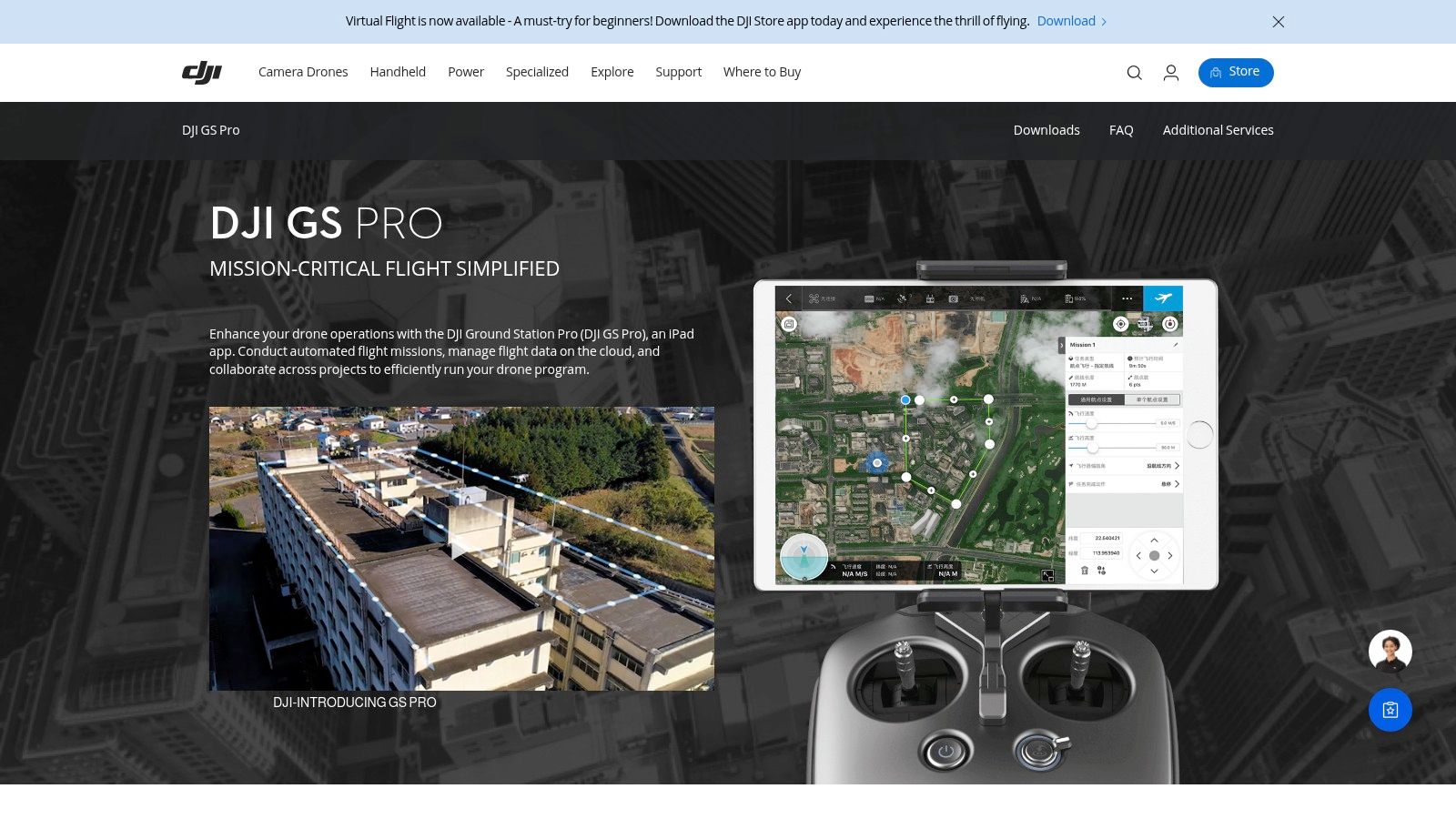
What makes GS Pro stand out is its seamless integration with DJI hardware and its focus on professional-grade mapping. It offers various mission types, including Tap and Go Waypoint, Virtual Fence for safety, and 3D Map Area for creating detailed models. While its interface is more technical than consumer-level apps, it rewards users with robust control over flight parameters like camera angle, overlap, and flight speed, ensuring high-quality data capture. The app's ability to manage flight missions and data directly on the iPad makes it a reliable field tool.
Key Details & Use Cases
Best For: Commercial operators, surveyors, and agricultural professionals using DJI drones for mapping and inspection tasks.
Pricing: The app itself is free to download, but advanced features like 3D mapping and KML/SHP file imports require a one-time in-app purchase (typically around $299).
Key Feature: Its deep, native integration with DJI drones provides unparalleled reliability and control for automated mapping missions without relying on third-party software.
Limitation: The platform is exclusive to Apple's iPad, completely excluding Android and desktop users. Its user interface has a steeper learning curve compared to more simplified apps.
9. UgCS (Universal Ground Control Software)
UgCS, which stands for Universal Ground Control Software, is a powerful and versatile drone flight planning app designed for professionals who require advanced control and compatibility across various drone platforms. It distinguishes itself with extensive hardware support, moving beyond DJI-only ecosystems to include drones from Parrot, MAVLink-compatible vehicles, and custom-built aircraft. This makes it an ideal choice for organizations managing a diverse fleet of UAVs for complex missions like industrial inspections, surveying, and security.
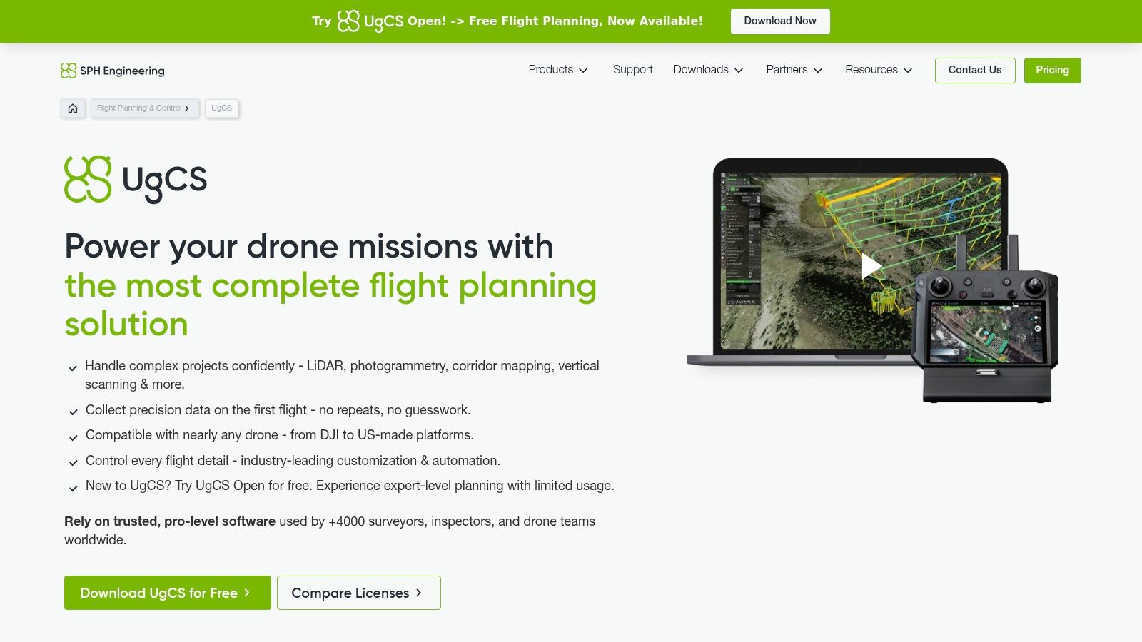
The software’s key strength lies in its sophisticated mission planning capabilities. UgCS enables true 3D mission planning with terrain-following and automatic obstacle avoidance by importing digital elevation models (DEM). Its architecture supports multi-drone operations, allowing a single operator to manage several UAVs simultaneously from one control station. While its extensive features present a steeper learning curve than simpler apps, the level of customization and control it offers is unparalleled for highly technical and demanding scenarios.
Key Details & Use Cases
Best For: Enterprise users, system integrators, and researchers who operate diverse drone fleets and require advanced, customized mission planning.
Pricing: Offered via perpetual licenses or subscriptions. UgCS Pro starts around $600/year, with more advanced tiers like UgCS Expert and Enterprise available for custom pricing. A free 14-day trial is available.
Key Feature: The platform’s true 3D mission planning environment, combined with its unique ability to support a wide range of different drone manufacturers and custom builds.
Limitation: The complexity and higher cost make it unsuitable for hobbyists or small businesses with basic needs. It requires dedicated training to leverage its full potential.
Website: https://www.ugcs.com
10. ArduPilot
ArduPilot is not a traditional app but rather a powerful, open-source autopilot software suite that forms the foundation for countless custom drone builds. It stands apart by offering unparalleled control and customization for developers, researchers, and advanced hobbyists. Unlike polished commercial drone flight planning app platforms, ArduPilot gives users direct access to the vehicle's core logic, allowing for the creation of highly specialized flight behaviors for multirotors, fixed-wing aircraft, rovers, and even submarines.
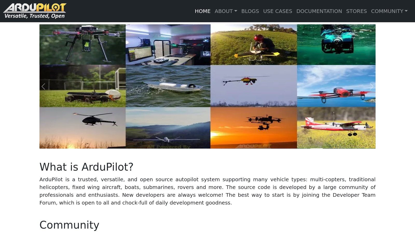
The power of ArduPilot lies in its versatility and extensive feature set, which includes fully autonomous waypoint navigation, advanced flight modes, and robust simulation capabilities. Users pair it with a ground control station software like Mission Planner or QGroundControl to design and execute missions. This setup is ideal for those who want to build a drone from scratch or modify an existing one for specific tasks, such as experimental sensor integration or unique aerodynamic testing, that off-the-shelf software cannot support.
Key Details & Use Cases
Best For: Developers, DIY drone builders, academic researchers, and advanced users who require deep customization.
Pricing: Completely free and open-source. Costs are associated with the physical hardware you choose to run it on.
Key Feature: Its open-source nature and compatibility with a vast range of hardware and sensors make it the most flexible and adaptable autopilot system available.
Limitation: It has a significant learning curve and requires a strong technical understanding of electronics, software, and drone dynamics for proper setup and tuning. It is not a plug-and-play solution for beginners.
Website: https://ardupilot.org
11. Mission Planner
Mission Planner is an open-source, full-featured ground control station for the ArduPilot ecosystem, making it a powerful drone flight planning app for developers, researchers, and advanced hobbyists. Unlike polished commercial software, it provides unparalleled, granular control over every aspect of a mission. Users can create intricate waypoint-based flight plans, configure specific sensor triggers, and monitor real-time telemetry data with an exhaustive level of detail. It is the go-to tool for anyone building or heavily customizing ArduPilot-based drones.
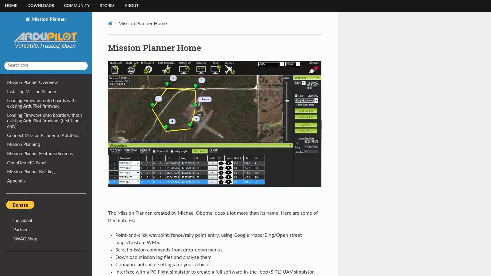
What truly distinguishes Mission Planner is its raw power and customizability, supported by a vast and active user community. The software allows for post-flight log analysis, firmware updates, and even offers a robust simulation environment to test missions without risking hardware. While its interface can feel dated and complex compared to subscription-based alternatives, this complexity is a direct result of its extensive capabilities. It empowers users to fine-tune flight parameters and system settings that are simply inaccessible in more streamlined applications.
Key Details & Use Cases
Best For: DIY drone builders, researchers, and technical users who require deep control over ArduPilot firmware and flight parameters.
Pricing: Completely free and open-source.
Key Feature: Its comprehensive suite of tools, including detailed waypoint planning, in-flight tuning, and post-mission log analysis, all within a single, free application.
Limitation: The steep learning curve and utilitarian user interface can be intimidating for beginners. It is also exclusively compatible with vehicles running ArduPilot firmware.
Website: https://ardupilot.org/planner
12. QGroundControl
QGroundControl is a powerful, open-source ground control station that offers full flight control and mission planning for drones running ArduPilot or PX4 firmware. Unlike proprietary software locked to specific hardware, this app provides a versatile and free solution for a wide range of custom-built and commercial drones. It is highly regarded in the developer and DIY drone community for its comprehensive vehicle setup, calibration, and real-time monitoring capabilities, making it a go-to drone flight planning app for technical users.
What makes QGroundControl stand out is its cross-platform compatibility and robust, community-driven development. It runs smoothly on Windows, macOS, Linux, iOS, and Android, giving pilots unparalleled flexibility in their choice of hardware. The interface is clean and functional, allowing for intuitive waypoint-based mission creation, parameter tuning, and direct flight control. While it lacks the automated analytics of enterprise platforms, its strength lies in providing meticulous, low-level control and extensive customization for pilots who need to fine-tune every aspect of their drone’s performance.
Key Details & Use Cases
Best For: DIY drone builders, researchers, developers, and pilots using PX4 or ArduPilot-based systems who require deep configuration options.
Pricing: Completely free and open-source.
Key Feature: Its universal compatibility with MAVLink-based autopilots (PX4 and ArduPilot) and broad cross-platform support make it an incredibly versatile and accessible tool.
Limitation: It primarily supports open-source flight controllers and may not be compatible with popular proprietary drones like those from DJI. Some advanced configurations can have a steep learning curve for beginners.
Website: https://qgroundcontrol.com
Top 12 Drone Flight Planning Apps Comparison
Software | Core Features | User Experience | Value & Pricing | Target Audience | Unique Selling Points |
|---|---|---|---|---|---|
2025 S Top Flight Planning | Real-time mapping, automated paths | ★★★★ User-friendly | 💰 Info-rich guide, no prices | 👥 Hobbyists & professionals | 🏆 Industry expert curation |
Litchi | Waypoint missions, VR support | ★★★★ Intuitive | 💰 One-time purchase | 👥 DJI drone users | ✨ VR headset, Mission Hub |
DroneDeploy | Automated planning, 3D modeling | ★★★★ Professional-grade | 💰 Subscription-based | 👥 Commercial & pros | 🏆 AI analytics, cloud platform |
Pix4Dcapture | Mapping missions, offline use | ★★★ Learning curve | 💰 Free app; paid processing | 👥 Photogrammetry users | ✨ Seamless Pix4D integration |
AirMap | Airspace maps, digital filing | ★★★★ User-friendly | 💰 Free basic; paid advanced | 👥 Regulatory-focused pilots | 🏆 Real-time space awareness |
Aloft (Kittyhawk) | Flight planning, compliance tools | ★★★★ Versatile interface | 💰 Free & subscription | 👥 Hobbyists & commercial | ✨ LAANC authorization, fleet mgmt |
Dronedesk | Flight planning, reporting | ★★★★ Intuitive | 💰 Scalable pricing | 👥 DJI users & pros | ✨ 50% planning time reduction |
DJI Ground Station Pro | Automated missions, multi-drone | ★★★★ Professional-grade | 💰 One-time purchase | 👥 Commercial iOS users | 🏆 DJI integrated, multi-drone mgmt |
UgCS | Terrain follow, obstacle avoid | ★★★ Advanced, requires training | 💰 Higher cost | 👥 Professional & advanced | ✨ Multi-autopilot support |
ArduPilot | Autonomous/manual modes | ★★★ Technical expertise req. | 💰 Free & open-source | 👥 Developers, advanced | 🏆 Highly customizable |
Mission Planner | Telemetry, simulation | ★★★ Complex for beginners | 💰 Free | 👥 ArduPilot users | ✨ Detailed mission control |
QGroundControl | Cross-platform, vehicle config | ★★★★ User-friendly | 💰 Free & open-source | 👥 PX4 & ArduPilot users | ✨ Wide platform & vehicle support |
Final Verdict: Choosing the Right App for Your Aerial Toolkit
Navigating the crowded market for a top-tier drone flight planning app can feel overwhelming, but as we've explored, the key is aligning the software's strengths with your specific mission objectives. The "best" app is not a one-size-fits-all solution; it is a strategic choice that enhances your workflow, ensures safety, and unlocks new creative or analytical potential from your aircraft.
Your selection process should begin with a candid assessment of your primary use case. Are you a commercial operator needing robust data processing for surveying, or a cinematographer seeking intricate, pre-programmed camera movements? The answer will immediately narrow your options.
Matching the Tool to the Task
From our deep dive into the leading platforms, several clear archetypes emerge for different types of pilots:
For Commercial & Enterprise Operations: If your work involves agriculture, construction, or large-scale surveying, the investment in a comprehensive platform like DroneDeploy or UgCS is often non-negotiable. These tools are far more than just flight planners; they are end-to-end operational hubs designed for data acquisition, processing, and fleet management. Their advanced features justify the subscription costs for businesses that rely on precise, repeatable results.
For Creative Professionals & DJI Enthusiasts: Pilots focused on aerial photography and videography will find immense value in Litchi. Its advanced waypoint and cinematic modes, like Focus and Orbit, provide a level of creative control that standard manufacturer apps simply cannot match. It’s the perfect tool for executing complex shots that would be nearly impossible to fly manually.
For Safety-Conscious & Regulated Flights: When operating in complex or controlled airspace, situational awareness is paramount. Aloft and AirMap excel in this domain, providing real-time airspace data, LAANC authorizations, and risk assessment tools. They are essential co-pilots for any operator who prioritizes compliance and operational safety above all else.
For the DIY & Open-Source Community: For tech-savvy pilots, custom drone builders, or those who demand ultimate control over every parameter, open-source solutions are the answer. Mission Planner and QGroundControl, built on the ArduPilot and PX4 ecosystems respectively, offer unparalleled customization. While they have a steeper learning curve, they provide the freedom to tailor every aspect of your flight plan and drone behavior.
Final Takeaways and Next Steps
Before committing to a particular drone flight planning app, consider these final implementation factors. First, evaluate your hardware compatibility. Ensure the app fully supports your specific drone model and controller. Second, assess your technical comfort level. An enterprise-grade solution like UgCS might be overkill for a hobbyist, while a simple app may frustrate a power user.
The most crucial takeaway is that a drone flight planning app is a force multiplier. The right choice will elevate your capabilities, streamline complex tasks into simple, automated workflows, and ultimately make you a safer, more efficient, and more creative pilot. Start by identifying your primary needs, use the free trials offered by many of these platforms, and don't be afraid to integrate multiple apps into your toolkit for different types of missions. This strategic approach will ensure you're always equipped with the perfect co-pilot for any aerial endeavor.
Are you ready to elevate your drone operations beyond the basics? At JAB Drone, we specialize in providing cutting-edge drone technology and expert guidance to help you master complex aerial tasks. Explore our range of professional-grade drones and accessories that integrate seamlessly with the industry’s best flight planning software at JAB Drone.
Comments