Ultimate Guide to the Best Drone with GPS Tracking
- Paul Simmons

- Aug 12, 2025
- 10 min read
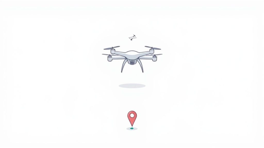
Ever tried to find your way through a new city without a map? Flying a drone without GPS is a lot like that—disorienting and a bit chaotic. A drone with GPS tracking isn't just some fancy extra; it's the core system that elevates a simple flying gadget into a smart, dependable tool for both work and play.
Why GPS Is Your Drone's Most Important Co-Pilot
Think of GPS as your drone's built-in spatial awareness. It’s the silent partner keeping your drone locked perfectly in place, even when a gust of wind tries to push it off course. Without it, the drone would just drift away, forcing you to constantly fight the controls just to hover.
This location-aware intelligence is what really separates today’s drones from basic remote-controlled toys. It's the technology that powers nearly every smart feature that makes flying easier and, more importantly, safer for pilots at any level.
The Foundation of Smart Flying
A drone with GPS tracking opens up a world of possibilities that would be a nightmare to attempt manually. This system is the bedrock for the features we now take for granted in the drone market.
Here’s a glimpse of what GPS brings to the table:
Rock-Solid Stability: The drone knows its exact coordinates, letting it lock its position in the air with incredible accuracy. This is the secret sauce for capturing silky-smooth video and tack-sharp photos.
Critical Safety Features: Lifesaving functions like "Return-to-Home" (RTH) are entirely dependent on GPS. If the drone loses its connection or its battery gets dangerously low, it uses its last known position to fly itself right back to where it took off.
Automated Flight Modes: Those cool cinematic shots, like circling a landmark or tracking a moving car, are all thanks to GPS. It gives the drone the data it needs to follow a precise, pre-planned flight path.
In short, GPS gives the drone a sense of self. It knows where it is, where it's been, and how to get home, which makes even complex flights feel intuitive and secure.
How Drones Pinpoint Their Location From Space
Ever wonder how a drone seems to just know where it is? It's not magic, but it is a pretty incredible conversation happening between your drone and a constellation of satellites orbiting high above us. Think of your drone not as just a receiver, but an active listener in a constant, high-speed dialogue that tells it exactly where it is on the globe.
It all starts with those satellites. Each one is continuously beaming out a signal packet that contains two critical pieces of information: its exact position and the precise time the signal was sent. The drone's built-in GPS receiver is designed to catch these signals from several satellites at once. By measuring the incredibly small delay between when a signal was sent and when it arrived, the drone can calculate its distance from each of those satellites.
From Signals To Stability
Once the drone knows its distance from at least four separate satellites, it uses a clever bit of math called trilateration.
Imagine drawing a giant, invisible sphere around three of those satellites. The radius of each sphere is the distance from that satellite to your drone. The single point where all three of those spheres cross is your drone's two-dimensional position—its latitude and longitude. So, what's the fourth satellite for? It adds the final, crucial piece of the puzzle: altitude.
This entire calculation happens many times every second. This gives the drone a live, highly accurate stream of data about its position, speed, and height. This constant flow of information is the foundation for almost every advanced feature we rely on, from holding a steady hover to executing a complex pre-planned flight path. It's what turns tricky aerial maneuvers into simple, reliable operations.
This level of precision is also fueling a massive global market for tracking devices. The market was valued at USD 3.74 billion and is expected to soar to USD 10.88 billion by 2033. You can dig deeper into the GPS tracking market and its projected growth over at Straits Research.
This infographic gives you a great visual breakdown of how those satellite signals become real, actionable data for your drone's flight controller.
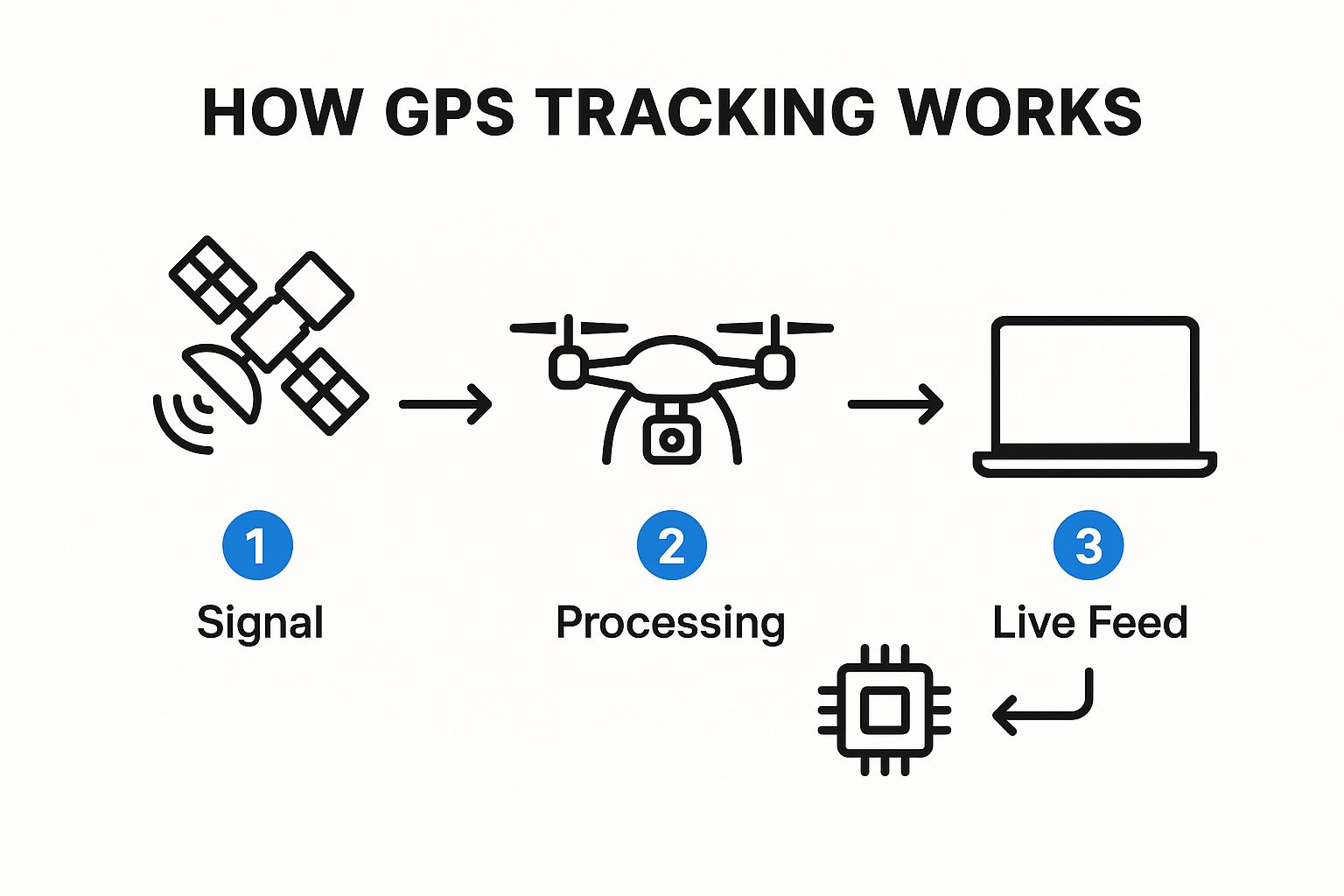
As you can see, it's a journey from a raw satellite ping to the processed location data that you see on your controller's screen. This location awareness is fundamental. When you pair it with a drone's other sensors, you get a powerful system for navigating the world safely. In fact, this GPS data is a key input for the systems that keep your drone from bumping into things. You can find out more about that in our guide on how drone collision avoidance systems really work.
Unlocking Your Drone's Smartest Features
These GPS-powered functions are what make modern drones so safe, reliable, and creatively powerful. Without GPS, many of the shots and safety features we now take for granted would be nearly impossible.
Essential Safety: The Return-to-Home Lifeline
Perhaps the most critical feature powered by GPS is Return-to-Home (RTH). Consider RTH your drone's digital safety net. If the battery gets dangerously low or, even worse, you lose the control signal, the drone doesn't just drift away or fall out of the sky.
Instead, it uses its saved takeoff coordinates to automatically fly back to where it started and land safely. This single feature protects your investment and provides an incredible amount of peace of mind every time you fly.
Automated Flight for Flawless Cinematic Shots
Beyond just safety, GPS is the engine that drives the sophisticated flight modes that make capturing professional-looking video so much easier. These automated features let you stop focusing on the complex stick movements and start focusing on composing the perfect shot.
The table below breaks down some of the most popular GPS-enabled features and what they do for you as a pilot.
GPS-Enabled Feature | Primary Function | Key Benefit |
|---|---|---|
Waypoint Navigation | Flies a pre-planned route using set GPS points on a map. | Get perfectly smooth, repeatable shots for things like site surveys or cinematic pans. |
Follow Me Mode | Locks onto the controller's GPS signal to autonomously track a moving subject. | Keeps you in the frame while you're biking, hiking, or driving, no manual piloting needed. |
Geofencing | Creates virtual boundaries on a map that the drone cannot cross. | Prevents you from accidentally flying into restricted airspace or beyond a safe range. |
As you can see, each of these modes relies on precise location data to work. They give your drone the intelligence to perform complex tasks reliably and on its own.
Ultimately, GPS isn't just about finding your drone—it's about giving it the power of control, safety, and creativity. It's what turns your creative vision into a tangible reality, shot after shot.
How GPS Drones Are Reshaping Industries
A drone with GPS isn't just for taking cool vacation photos anymore. These intelligent aircraft have become serious professional tools, completely changing how entire industries get work done. They're making the jump from a hobbyist gadget to a core part of professional workflows, delivering a level of precision and efficiency that was once out of reach.
This isn't just a fleeting trend. We're talking about a fundamental shift in how businesses collect data, manage physical assets, and operate on a daily basis.
The numbers tell the story. The global market for drone trackers was recently valued at around USD 4.5 billion. Experts project it will more than double, hitting USD 10.2 billion by 2033. This incredible growth is a direct result of industries relying more and more on GPS for both safety and operational excellence. You can check out the full drone tracker market forecast on Verified Market Reports.
From Fields to Construction Sites
This technology is already delivering tangible results across a huge range of sectors. It’s not science fiction; it’s happening right now.
Here are a few powerful examples of GPS drones in action:
Precision Agriculture: Farmers are using GPS-guided drones to get a bird's-eye view of their crops with surgical accuracy. They can analyze specific sections of a field and apply water or pesticides only where needed, which saves a ton of resources and boosts crop yields. You can dive deeper into how drones are improving farming in our detailed guide.
Construction and Surveying: Picture a massive construction site. A drone can fly a pre-programmed path completely on its own, creating incredibly accurate 3D maps and models. This helps with initial site planning, tracking progress over time, and even keeping workers safe by spotting potential hazards from above.
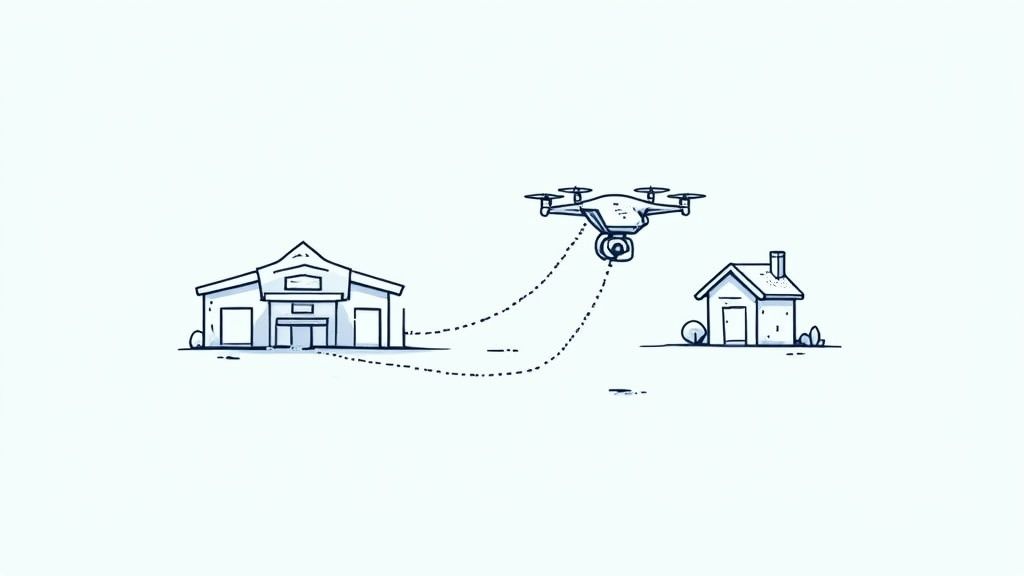
Logistics and Delivery: For companies building automated delivery services, precise navigation is everything. GPS tracking is the key that allows a drone to navigate a complex city, avoid obstacles, and land at its exact destination safely and reliably, every single time.
What these examples show is that the real power of a GPS drone is its ability to perform specific, repeatable tasks with a level of accuracy that humans often can't match. It transforms simple aerial data into a powerful business asset.
And it’s interesting to see how this same core technology is making waves in completely different fields. For example, GPS tracking systems are revolutionizing athlete performance in sports by giving coaches incredibly detailed data on player movement and exertion.
Choosing the Right Drone with GPS Tracking
Picking the perfect drone with GPS isn't about grabbing the priciest model off the shelf. It’s about matching the right tech to what you actually want to do. Whether you’re a total beginner, a filmmaker chasing the perfect shot, or a commercial operator, digging into a drone's GPS capabilities is key to making a smart investment.
At the heart of any drone's GPS system are two things: accuracy and reliability. When you're comparing models, look for ones that support multi-constellation systems. This is a fancy way of saying the drone can talk to more than just the American GPS network. It can also tap into GLONASS (Russia), Galileo (Europe), and BeiDou (China).
The more satellites a drone can connect with, the faster it locks onto its position and the more stable it stays in the air. This is a game-changer in tricky spots like urban canyons between tall buildings or deep in a forest.
Matching GPS Features to Your Needs
Different pilots have wildly different needs. A hobbyist just flying for fun is a world away from a professional surveyor mapping a construction site. To cut through the marketing fluff, think about what you'll actually be doing with your drone.
For Beginners and Hobbyists: Your biggest concerns are safety and ease of use. A drone with solid, basic GPS that offers a reliable Return-to-Home (RTH) function and stable hovering is all you need. You don't need centimeter-level accuracy, just a dependable signal that brings your drone back safely.
For Content Creators: You’re after precision for those smooth, cinematic shots. You should prioritize drones with advanced GPS-powered flight modes like Waypoints and Follow Me. A rock-solid signal is crucial to make sure your automated shots go off without a hitch.
For Commercial Use: This is where top-tier GPS becomes non-negotiable. For jobs like agricultural mapping or construction surveying, you’ll need a drone with RTK (Real-Time Kinematic) or PPK (Post-Processed Kinematic) capabilities. These systems deliver centimeter-level accuracy, which is absolutely essential for creating precise 3D models and survey data you can count on.
Choosing a drone is a process of balancing features, performance, and budget. It’s about identifying your primary goal and finding the GPS technology that best supports it.
Ultimately, picking the right drone comes down to lining up its tech specs with your real-world goals. For a deeper dive into this process, our complete guide on [how to choose a drone](https://www.jabdrone.com/post/how-to-choose-a-drone-a-practical-guide) is packed with even more practical tips.
The Future of Drone Safety and Airspace Security
As more and more drones take to the skies, the conversation is naturally shifting. We're moving beyond cool features for individual pilots and starting to think about the collective safety of our airspace. A drone with GPS tracking isn't just a neat tool for one person anymore—it's the very foundation for creating a secure and organized environment for everyone.
This is where GPS data becomes part of a much bigger picture involving security. Authorities rely on this information to enforce no-fly zones around sensitive areas like airports, government facilities, or even big public events. If an unauthorized drone drifts into restricted airspace, detection systems can instantly pinpoint its location, allowing for a quick and effective response.
The Rise of Digital License Plates
This growing need for aerial security is fueling some serious market growth. The drone detection and tracking market, once valued around USD 730 million, is now projected to soar to nearly USD 941 million by 2030. This boom is driven by a mix of technologies like radar, AI, and of course, GPS, all working together to secure our skies.
A huge piece of this puzzle is Remote ID. The simplest way to think of it is as a digital license plate for your drone. This regulation mandates that most drones broadcast their identification and location info, which can be picked up by authorities and even the general public.
This system introduces a whole new level of accountability and transparency, and it's a critical step toward integrating drones safely into our national airspace. If you're a drone operator, getting a handle on these rules is non-negotiable. You can get up to speed by checking out our complete, stress-free guide to drone FAA registration.
Looking even further down the road, GPS will be the linchpin for future aerial transit systems, including the exciting development of Urban Air Mobility (UAM) solutions.
Frequently Asked Questions About GPS Drones
Jumping into the world of GPS drones always brings up a few questions. It's a lot to take in at first, so let's clear up some of the most common things people ask. Here are some straightforward answers to help you get a better handle on what to expect from a drone with GPS tracking.
How Accurate Is Drone GPS?
For most consumer drones you'd buy off the shelf, the GPS is accurate enough to hold its position within a few feet, both horizontally and vertically. This is more than enough for a rock-solid hover and getting those basic automated shots just right.
However, when you step up to the higher-end models, things get even more precise. These drones often tap into multiple satellite constellations at once (like GPS, GLONASS, and Galileo), which can lock their position down to just a few inches.
Can I Fly Without A GPS Signal?
Yes, you absolutely can fly without a satellite lock, but it’s a whole different ball game. Without GPS, your drone will flip into a manual flight mode, often called "Attitude" or ATTI mode. In this state, it won't hold its position on its own and will drift with even the slightest breeze.
Important: Flying in ATTI mode means all your GPS-based safety nets are gone. No automatic Return-to-Home if you lose signal, no position hold for stable shots, and no geofencing to keep you out of restricted areas. It's flying on pure stick skills.
Does GPS Drain The Drone Battery?
The GPS receiver itself barely sips any power; it's a very low-drain component. The real battery hogs are the intelligent flight modes that depend on that GPS data.
Think about it: features like Follow Me or complex Waypoint missions require the drone's brain to constantly calculate its position and make thousands of tiny motor adjustments to stay on course. That continuous work consumes a lot more energy than just hovering in one spot. For a deeper dive into how this works in other industries, learning about real-time GPS tracking systems used in logistics can offer some fascinating parallels.
Ready to explore the skies with confidence? At JAB Drone, we provide the expert reviews, guides, and insights you need to choose the perfect drone for your adventures. Visit us at https://www.jabdrone.com to learn more.
Comments