Drone Maximum Altitude: How High Can You Fly Safely?
- Paul Simmons

- Jul 4, 2025
- 17 min read
When someone asks how high a drone can fly, there's never one simple answer. The truth is, a drone's maximum altitude isn't a single number you can pull off a spec sheet. It's a dynamic limit defined by a mix of legal rules, the drone's own hardware, and the environment you're flying in.
Understanding Your Drone’s True Altitude
Think of it like a high-performance sports car. The speedometer might go up to 200 mph—that's its technical limit. But the legal speed limit on the highway is 70 mph, and on a rainy day with slick roads, you might only feel safe going 50 mph.
A drone's altitude works the exact same way. You have what the drone can do, what you're allowed to do, and what's safe to do based on current conditions. Getting a firm grip on these three pillars is what separates a smart pilot from a reckless one. Ignoring any of them can lead to a lost drone, hefty fines, or worse.
To make this a bit clearer, here's a quick breakdown of the different altitude limits you need to know before every flight.
Quick Guide to Drone Altitude Limits
This table summarizes the different factors that define your drone's maximum altitude in any given flight.
Altitude Type | What It Means | Governed By |
|---|---|---|
Regulatory Altitude | The maximum legal height you are allowed to fly. | National aviation authorities (e.g., the FAA in the US). |
Technical Altitude | The physical height limit of the drone itself. | The drone's hardware (motors, props) and software settings. |
Operational Altitude | The realistic, safe height based on current conditions. | Weather, wind, air density, and obstacles. |
Your actual flight ceiling will always be the lowest of these three values.
The Three Pillars of Drone Altitude
The true ceiling for any flight is always determined by whichever of these three factors is the most restrictive at that moment.
Regulatory Limits: These are the hard-and-fast legal ceilings set by aviation authorities. For most pilots in the U.S., the Federal Aviation Administration (FAA) sets this at 400 feet (120 meters) above ground level (AGL). These rules exist for one crucial reason: to keep your drone safely away from airplanes and helicopters.
Technical Capabilities: Every drone has a "service ceiling"—a physical limit baked into its hardware. This is determined by things like motor power, propeller design, and battery life. Manufacturers often set a lower, software-enforced limit to keep you from pushing the hardware past its breaking point.
Environmental Conditions: The world around you has a huge say in how high your drone can safely go. Things like air density (which changes with temperature and elevation), wind speed, and incoming weather can slash your effective altitude in half.
This diagram brings it all together, showing how these three components interact to define your drone's real-world maximum altitude.
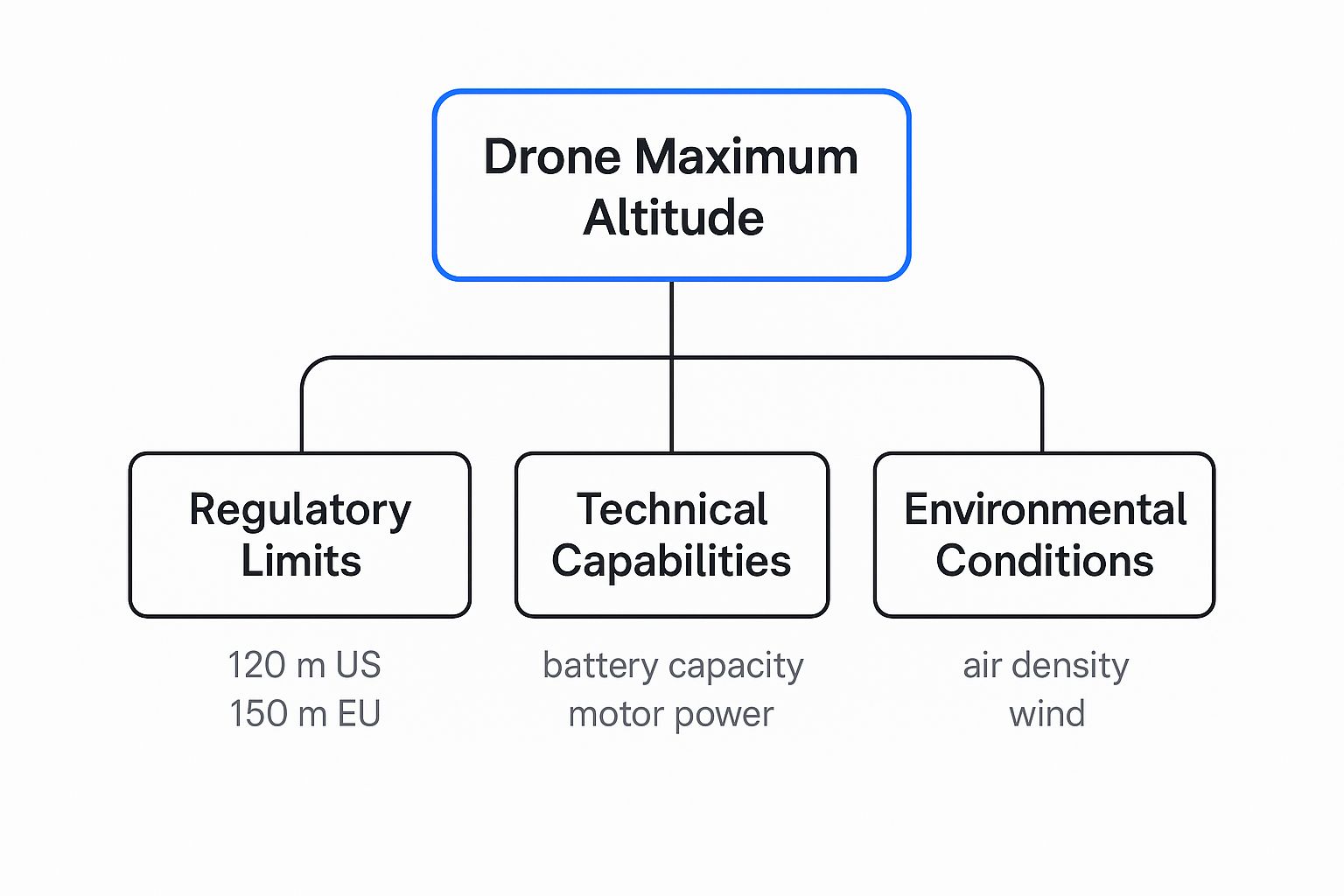
As you can see, your drone's actual flight ceiling is always dictated by the lowest of these three limits on any given day.
Why This Matters for Every Pilot
One of the most common mistakes new pilots make is looking only at the technical specs on the box. So your drone can technically reach 20,000 feet? That's impressive, but it’s also completely irrelevant if the law says 400 feet and powerful winds make it unsafe to fly above 200 feet.
The best and safest pilots understand that technical possibility does not equal operational permission. Your true maximum altitude is a fluid number that you have to figure out before every single flight, taking into account the law, your gear, and the day's weather.
Ultimately, mastering high-altitude flight isn't about pushing your drone to its absolute limit. It's about operating with skill and awareness inside the boundaries set by common sense, regulations, and real-world conditions.
Navigating the Legal Altitude Ceiling
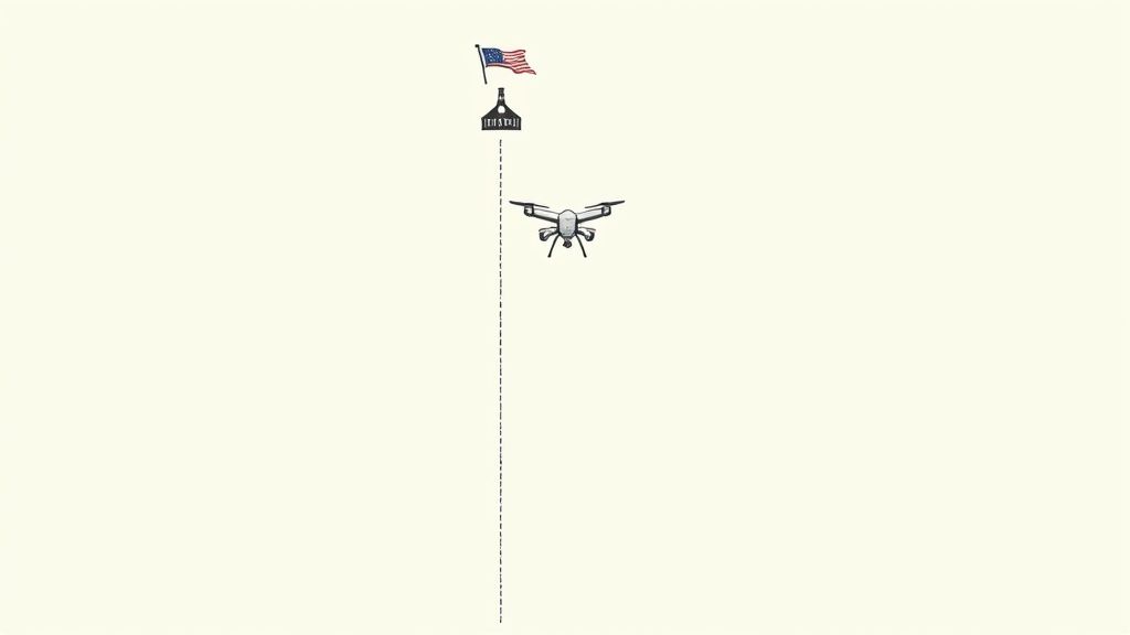
While your drone might have the technical muscle to climb thousands of feet into the sky, the law brings it much closer to home. For almost every drone pilot in the United States, there's one number you have to burn into your memory: 400 feet (120 meters). This isn't a friendly suggestion—it's a firm rule set by the Federal Aviation Administration (FAA).
Why the hard limit? It boils down to one critical thing: safety. The airspace above 400 feet is the domain of manned aircraft like airplanes and helicopters. By keeping drones below this altitude, we create a predictable and safe buffer zone, drastically reducing the risk of a catastrophic mid-air collision.
But what does 400 feet really mean when you're out in the field? It’s not measured from where you’re standing. It’s measured from the ground directly underneath your drone. This simple but vital concept is known as Above Ground Level (AGL).
Understanding Above Ground Level
Picture this: you're standing at the bottom of a 150-foot hill. If you fly your drone straight up 400 feet, you've hit your legal ceiling. But what if you fly horizontally from your position to hover over the peak of that same hill?
Your drone might now be 550 feet higher than where you took off, but it's only 400 feet above the hilltop. In this case, you're still perfectly legal.
The 400-foot rule is like a "blanket" that drapes over the terrain. Your job is to make sure your drone never pokes more than 400 feet above that blanket, whether the ground below is a flat field, a rolling hill, or the roof of a building.
This distinction is absolutely crucial for flying safely and legally, especially when the landscape isn't perfectly flat. Remember, your drone’s altimeter usually measures height from its takeoff point, so you have to stay mindful of the ground elevation directly beneath it at all times.
The Skyscraper Exception
Of course, the FAA knows that some jobs, like inspecting a cell tower or the side of a skyscraper, just can't be done from below 400 feet. For these specific situations, there’s an exception built for commercially licensed pilots.
If you are a Part 107 certified pilot, you can fly above the 400-foot AGL limit, but only under specific conditions. Your drone must stay within a 400-foot radius of a structure and not fly more than 400 feet above that structure's highest point. This rule allows for critical inspections without threatening other air traffic, since manned aircraft are already required to avoid tall obstacles.
If you’re thinking about doing commercial work, understanding why you need a Part 107 license is the first step toward unlocking these kinds of advanced flights.
Getting Authorization for Higher Flights
So, what if you have a legitimate commercial reason to fly above 400 feet in open airspace, far from any tall structures? It's not impossible, but it does require getting special permission directly from the FAA.
Pilots can apply for airspace authorizations and waivers through systems like the Low Altitude Authorization and Notification Capability (LAANC). This system gives drone pilots access to controlled airspace (like near airports) and is the gateway for requesting to fly beyond standard altitude limits in certain areas.
Getting a waiver to fly above 400 feet AGL isn't a walk in the park. You have to build a rock-solid safety case proving your flight won't pose any risk to the national airspace. This usually involves:
Detailed Flight Plans: You’ll need to specify the exact location, time, and maximum altitude you’re requesting.
Risk Mitigation Strategies: You must outline your emergency procedures for everything from equipment failure and lost connections to surprise encounters with manned aircraft.
Advanced Equipment: Often, this requires drones with enhanced reliability, backup systems, and ADS-B receivers that can detect nearby aircraft.
For most hobbyists and even many commercial pilots, just sticking to the 400-foot AGL rule is the simplest and safest path. Pushing the drone maximum altitude without the right paperwork isn't just a rule violation; it's a serious safety hazard that can result in hefty fines and legal trouble.
Exploring Your Drone's Technical Limits
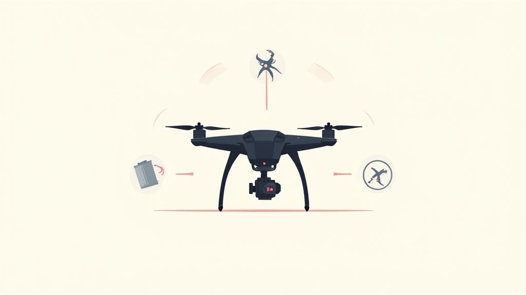
So, you've memorized the legal altitude caps. But have you ever been flying on a perfectly clear day, with a full battery, and wondered why your drone just… stops climbing? It's not a glitch. You're bumping up against the built-in technical limits set by the manufacturer or the unyielding laws of physics.
These technical ceilings are a huge piece of the drone maximum altitude puzzle. They're there for a reason—to protect the drone from damaging itself and to keep you from accidentally flying into a bad situation. Getting a handle on these limits is the key to understanding what your aircraft is really capable of.
The Software-Enforced Ceiling
The most common barrier you'll hit is a software-enforced altitude cap. Big-name manufacturers like DJI program a maximum altitude right into the drone's flight controller software. This is usually set to match local rules, like the 120 meters (about 400 feet) limit here in the United States.
This isn't a bug; it's a very deliberate safety feature. It works like a form of geofencing, creating an invisible box the drone simply won't fly out of. While you can sometimes adjust it in your settings, this software limit is designed to stop pilots from effortlessly—and unknowingly—breaking aviation laws.
These systems are also connected to new requirements like Remote ID, which broadcasts your drone's location and altitude for accountability. If you want to get into the weeds on that, you can learn more about [what Remote ID is](https://www.jabdrone.com/post/what-is-remote-id) and how it acts like a digital license plate for your drone.
Think of it like the governor on a rental scooter. The engine could probably go faster, but it's electronically capped at a safe, legal speed. Your drone's software does the exact same thing for its altitude.
The Physics of Thin Air
But let's say you could strip away all those software limits. Your drone would still eventually hit a physical wall. This is its service ceiling—the altitude where physics basically says, "nope, no higher." The main culprit? Air density.
Imagine trying to swim. The water gives you something solid to push against to move forward. Now, imagine trying to "swim" through the air; you wouldn't get very far. A drone's propellers work on the same principle, generating lift by pushing down on air molecules.
As your drone climbs, the air gets significantly thinner. This means there are fewer air molecules for the props to grab onto. To stay airborne, the motors have to spin much, much faster to generate the same amount of lift.
This extra effort creates a domino effect: the motors pull more power, the battery drains like crazy, and the whole system starts to overheat. Eventually, the motors hit their max RPM and just can't spin any faster. At that point, they can't generate enough lift to climb even one more foot in the thin atmosphere.
The Chilling Effect of Altitude
Another major physical hurdle is temperature. For every 1,000 feet you climb, the air gets about 3.5°F (2°C) colder. That might not seem like a big deal, but it can absolutely cripple your drone's most important component: the battery.
The lithium-polymer (LiPo) batteries that power most drones absolutely hate the cold. Low temperatures slow down the internal chemical reaction that releases energy, causing a sharp drop in voltage often called "voltage sag."
This can lead to a few nasty problems:
Reduced Performance: Your flight controller might see the voltage drop and think the battery is critically low—even if it's at 70%—triggering an emergency landing.
Shorter Flight Times: In the cold, the battery just can't deliver its power efficiently, which will slash your flight time.
Sudden Power Loss: In the worst-case scenario, the voltage can plummet so far that the drone completely loses power and simply falls out of the sky.
This is why many high-end drones come with self-heating batteries, but even those have their limits when you're dealing with the frigid air at high altitudes.
The Unseen Limit of Signal Strength
Finally, we have the technical limitation that most pilots run into first, and it has nothing to do with air density or temperature. It’s all about the connection between your controller and the drone.
Most consumer drones rely on radio frequencies to send your commands and receive that live video feed. This signal has a finite range and is easily blocked by things like trees, buildings, or even a small hill. As your drone gets higher and farther away, that signal gets weaker and weaker.
Long before your drone even approaches its physical service ceiling, you're likely to see a choppy video feed or, worse, lose the control link entirely. In the real world, your drone maximum altitude is often defined not by how high it can fly, but by how high it can fly while still maintaining a rock-solid connection to you on the ground.
How the Environment Governs Your Flight Altitude
Your drone’s performance isn’t just about the hardware packed inside it; it's constantly negotiating with the world around it. While the law and the drone's specs set clear boundaries, the environment is what dictates your true drone maximum altitude on any given day. Trying to fly without respecting these real-world conditions is like trying to sail a small boat in a hurricane—you’re simply fighting a battle you can't win.
Think of it as a dance between your drone’s power and the atmosphere’s resistance. Every good pilot knows how to read the environment to make smart, safe decisions before and during every flight.
The Challenge of Density Altitude
One of the most critical environmental factors—and one that many pilots surprisingly overlook—is density altitude. This isn't just about your physical elevation. It’s a combined measure of altitude, temperature, and humidity that determines how "thick" or "thin" the air is, which directly impacts your drone’s ability to generate lift.
Imagine your drone's propellers are like hands trying to climb a rope. In cool, dry air at sea level, the rope is thick and easy to grip. That’s a low density altitude. But on a hot, humid day at a high elevation, that same rope becomes thin and greasy. Your hands—or in this case, the propellers—have to work much, much harder just to get the same grip. That’s a high density altitude environment.
Flying a drone in Denver on a 95°F (35°C) day is dramatically more demanding than flying at sea level on a cool day. Even if both locations are at the same legal altitude, the drone in Denver is fighting thinner air, forcing its motors to work overtime and draining the battery much faster.
This invisible force is exactly why your drone might feel sluggish and struggle to climb on a hot summer afternoon, even when it felt zippy and powerful that same morning.
The Unseen Dangers of Wind and Weather
High winds are another major environmental hazard that can easily overpower your drone. Sure, your drone might be rated to fly at 30 mph, but if it runs into a 40 mph headwind at altitude, it won’t just stop moving forward. It will actually start flying backward, no matter how hard you push the controls. This is a classic recipe for a flyaway and a lost drone.
Flying into clouds brings a whole different set of critical risks. It’s not just about losing your visual line of sight, which is a massive safety and legal no-go. The moisture inside a cloud can cause a host of serious problems:
Moisture Damage: Water can easily seep into the electronics, leading to short circuits and catastrophic failure.
Propeller Icing: In cold conditions, moisture can freeze on the propellers, changing their aerodynamic shape and completely destroying their ability to generate lift.
Signal Loss: The dense water vapor in clouds can block or interfere with your radio signal, causing a sudden loss of control.
Understanding these environmental factors is what separates a knowledgeable pilot from a lucky one. Before you even think about taking off, take a moment to assess the conditions to figure out your real-world operational ceiling.
This table gives a quick summary of how key environmental factors can impact your drone's ability to perform.
How Environmental Conditions Affect Drone Altitude Performance
Environmental Factor | Impact on Drone Performance | Practical Consideration |
|---|---|---|
High Temperature | Decreases air density, forcing motors to work harder and reducing lift efficiency. | Expect shorter flight times and reduced climbing power on hot days. |
High Elevation | Significantly thins the air, which severely limits the drone's service ceiling. | Be extra cautious when flying in mountainous regions; your effective altitude is much lower. |
Strong Winds | Can overpower the drone's motors, leading to flyaways and instability. | Check wind speeds at your intended altitude, as they are often much stronger than on the ground. |
Clouds & Fog | Can cause moisture damage, icing, and complete loss of visual line of sight. | Never fly into clouds. It violates VLOS rules and poses a direct threat to your equipment. |
Ultimately, the environment always has the final say. By respecting its power, you empower yourself to fly smarter, safer, and with more confidence every single time you take to the skies.
When Drones Push Past the Limits
While rules and physics tell you how high you should fly, there’s a whole other world where pilots push their drones well past those lines. It's a bit of a wild west, full of stories that show the massive gap between what a drone can technically do and what's actually safe and legal. These flights, while often reckless, offer some powerful lessons for the rest of us.
One of the most talked-about examples of this happened back in 2016. A video popped up online showing what looked like a regular consumer drone reaching an altitude that was just staggering, proving the raw power hiding inside everyday gear.
Here's a screenshot from that infamous flight. You can see the drone's telemetry as it soared thousands of feet into the sky.
The display clearly shows the drone blowing past 3,300 meters, which is nearly 11,000 feet. That's not just high; that's commercial airliner territory.
The Legendary 11,000-Foot Phantom Flight
This wasn't just any drone. It was a heavily modified DJI Phantom 2, and its flight kicked up a firestorm of debate across the drone community. A European hobbyist supposedly flew the drone to this jaw-dropping altitude, completely shattering the drone’s built-in 1,500-foot software limit and making the legal 400-foot ceiling look tiny in comparison. An old article from Popular Mechanics actually dug into the details of this controversial flight and the community's heated reaction.
Sure, it was an impressive technical feat. But it was also profoundly dangerous. At 11,000 feet, the drone was flying blind deep inside airspace meant for commercial jets, private planes, and medevac helicopters. A collision at that height would be catastrophic, and the pilot had no real way to see or avoid anything else up there.
This incident perfectly captures the central conflict of high-altitude drone flight: a drone's technical ability often stretches far beyond a pilot's legal and ethical authority. Just because you can do something doesn't mean you should.
The flight was a massive wake-up call for the industry. It put a spotlight on the urgent need for better geofencing, more thorough pilot education, and reliable safety tech. Without effective [drone collision avoidance systems](https://www.jabdrone.com/post/drone-collision-avoidance-top-systems-for-safer-flights), a flight like this is just a reckless gamble with people's lives.
Professional Drones in Extreme Environments
Now, let's flip the script. In stark contrast to reckless high-flying, there's a world where extreme altitude missions are pulled off safely and for a good reason. Specialized drones are being built to work in some of the most unforgiving places on Earth, including the Himalayas.
These aren't the drones you buy off the shelf. They are purpose-built machines engineered from the ground up to tackle the unique physics of high-altitude flight:
Optimized Aerodynamics: Their props and frames are designed specifically to generate enough lift in incredibly thin air.
Advanced Power Systems: They often run on high-performance batteries that are temperature-regulated, or even hybrid gas-electric engines, to keep them running in the brutal cold.
Redundant Systems: These drones are packed with backups. Multiple control, navigation, and communication systems ensure that a single failure doesn't bring the whole mission down.
For instance, specialized drones are now doing incredible work like delivering critical medical supplies to remote mountain villages and helping search-and-rescue teams on Mount Everest. These missions push the drone maximum altitude to its absolute limit, but they do it under tightly controlled conditions, with clear goals and extensive safety plans.
These professional flights show the amazing potential of high-altitude drone tech when it’s used with expertise and a sense of responsibility. They're the perfect counterpoint to the unauthorized joyrides, proving that pushing boundaries can serve a real purpose when it's done right.
Best Practices for Safe High Altitude Flying
It’s one thing to know the rules and technical limits that dictate your drone maximum altitude. It’s another thing entirely to put that knowledge into practice safely and consistently. A successful high-altitude flight isn't just about pushing a button; it's the result of diligent planning and a safety-first mindset.
Turning theory into action means building a solid pre-flight routine. This isn't just a quick glance at your battery levels. It’s about creating a complete mental map of the entire flight before your propellers even spin up. This discipline is what allows you to confidently explore your drone's full potential without putting people or property in danger.
Your Pre-Flight Safety Checklist
Before any flight—especially one where you plan on pushing toward that legal ceiling—make this checklist a habit. It’s how you turn abstract rules into concrete actions that keep you, your drone, and everyone else safe.
Check Your Airspace and Weather: Don't just look up at the sky. Fire up an app like the FAA's B4UFLY to check for airspace restrictions, TFRs (Temporary Flight Restrictions), and whether you're too close to an airport. Critically, look at detailed weather reports for wind speeds at altitude. What feels like a calm day on the ground can be a windstorm a few hundred feet up.
Know Your Drone's Limits: Every drone handles differently. You need to intimately understand your specific model's wind resistance, how cold affects its battery, and its true service ceiling. Trying to fly a beginner drone at high altitude is a whole different ballgame—and a much riskier one—than using a professional model built for those conditions.
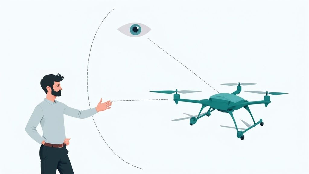
Maintain Visual Line of Sight (VLOS). Always. This is the golden rule, and it's non-negotiable. At 400 feet, most consumer drones are just a tiny speck against the sky. It is shockingly easy to lose sight of it, and the moment you do, you've lost the ability to see and avoid other aircraft or unexpected obstacles.
A huge mistake many pilots make is thinking their camera view (FPV) counts as VLOS. It absolutely does not. The law requires that you or a dedicated visual observer can physically see the drone with your own eyes at all times.
Smart In-Flight Management
Once you’re in the air, your job isn’t over. High-altitude flights are more demanding on your drone, and you need to be smart about managing its resources.
Manage Your Battery Power Wisely
Climbing straight up takes a massive amount of power compared to just hovering. The air is thinner, the motors work harder, and your battery will drain much faster than you’re used to.
Plan for a Shorter Flight: Just assume you'll get less flight time than the box says.
Be Conservative with "Return to Home" (RTH): Don't wait for the drone's automatic low-battery warning. A smart pilot sets the RTH trigger to 30% or even 40%. This creates a huge safety buffer, ensuring your drone has more than enough juice to fight a surprise headwind on its journey back to you.
Sticking to these steps builds a powerful safety net around every single flight. For a much deeper look into this, check out our comprehensive guide on [drone safety tips to avoid common accidents and hazards](https://www.jabdrone.com/post/drone-safety-tips-how-to-avoid-accidents-and-hazards).
Frequently Asked Questions About Drone Altitude
Even when you feel like you have a solid handle on the rules, flying a drone always brings up a few practical questions. Let's walk through some of the most common ones I hear from other pilots to make sure you're ready for a safe and informed flight.
How Do Drones Actually Measure Their Altitude?
It’s a great question, and the answer is a bit of a team effort between different sensors. The primary tool is a barometric pressure sensor, which is essentially a tiny altimeter. It works by measuring air pressure. As the drone climbs, the air gets thinner, the pressure drops, and the drone uses that change to calculate its height relative to its takeoff point.
But that's not the whole story. Most modern drones also pull in GPS data. By communicating with satellites, the drone can pinpoint its location in three-dimensional space, which includes its altitude above sea level. Combining both barometer and GPS readings gives you a much more stable and accurate idea of just how high you are.
What Is the Best Altitude for Flying a Drone?
There’s really no single "best" altitude. The right height is all about what you're trying to accomplish with that specific flight.
For stunning photos and videos: You'll often get your best shots flying lower, somewhere between 50 and 200 feet. This range helps capture rich detail and creates a powerful sense of perspective and motion.
For mapping or surveying jobs: Here, you'll want to fly higher, often pushing closer to that legal 400-foot ceiling. Flying higher lets you cover a lot more ground in a single battery, giving you that wide, top-down view essential for creating maps.
Ultimately, the perfect altitude is always a balancing act between your creative goals and what's safe and legal for the area you're flying in.
At the end of the day, you are the pilot in command. The responsibility for keeping your drone at a safe and legal altitude rests entirely on your shoulders. You are the final authority, no matter what the drone's software might tell you is possible.
Can I Fly My Drone Above 400 Feet at Night?
Nope. The altitude rules don't change just because the sun has set. The maximum legal altitude is still 400 feet AGL (Above Ground Level) for night operations.
On top of that, remember that flying at night has its own set of rules. Your drone must be equipped with anti-collision lights that are visible from at least three statute miles away. This is crucial for helping other aircraft, like planes and helicopters, see your drone in the dark.
Ready to take your drone knowledge to the next level? At JAB Drone, we provide expert reviews, in-depth guides, and the latest news to help you fly smarter and safer. Explore our resources and join a community of passionate pilots at https://www.jabdrone.com.
Comments