Where Can I Fly My Drone Safely and Legally
- Jab Media

- Aug 18, 2025
- 16 min read
Updated: Aug 19, 2025
So, you're cleared to fly your drone in most uncontrolled airspace as long as you stay below 400 feet. But before you launch, you have to be sure there are no local rules, temporary flight bans, or sensitive areas like airports or national parks anywhere nearby.
The golden rule is simple: always check a trusted drone map app like B4UFLY before every single flight. This one step will tell you if your chosen spot is clear and legal to fly.
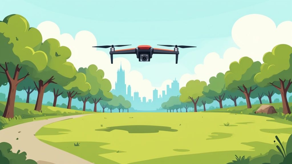
Quickly Find Safe and Legal Places to Fly
You've just unboxed your shiny new drone, the battery is juiced up, and you're itching to get it in the air. But hold on. The most important question is still hanging there: where can I actually fly this thing without causing a problem? It’s not just about finding an open field; it's about seeing the invisible lines and rules in the sky to keep every flight safe and on the right side of the law.
Think of it like a pilot's pre-flight check. Before a 747 even thinks about pushing back from the gate, the crew runs through a detailed checklist. As a drone pilot, you need that same mindset. This pre-flight location check is a quick, repeatable habit that will tell you if you’re good to go.
Your Essential Pre-Flight Habit
At its core, this habit is about answering a few straightforward but absolutely critical questions about where you plan to fly. These questions touch on the three main pillars of drone safety and compliance.
Airspace Awareness: Is the sky above me controlled or uncontrolled? How close am I to an airport?
Ground-Level Restrictions: Are there any specific local rules for this park? Is this a national park or other federally protected land?
Operational Safety: Can I maintain a clear line of sight with my drone? Am I able to stay under the 400-foot ceiling and steer clear of flying directly over people?
Getting answers to these questions takes all the guesswork out of the equation. For instance, your backyard might seem like the perfect spot, but if you live within five miles of an airport, you're almost certainly in controlled airspace and need authorization to fly. That beautiful local park might look ideal for getting some great shots, but a city ordinance could have a blanket ban on all drone flights.
Before you even think about launching, your number one job is to build a complete picture of your flight environment. Just looking around isn't enough—you have to use digital tools to understand the rules governing that specific patch of sky you want to fly in.
To make this dead simple, we've put together a quick checklist covering the most common places people fly their drones. Think of this table as your mental cheat sheet before you power on the props. It’s a structured way to spot potential red flags right away, turning a potentially complex decision into a simple, confident "yes" or "no."
Pre-Flight Location Checklist
Use this table to quickly run through the key safety and legal checks for common drone flying spots.
Location Type | Key Questions to Ask Before Flying | Common Restrictions to Check |
|---|---|---|
Your Backyard | Is my property in controlled airspace (near an airport)? Can I fly without bugging my neighbors or invading their privacy? | Airport proximity, local privacy laws, and any active Temporary Flight Restrictions (TFRs). |
Local Park | Does this city or county have specific rules banning drones in parks? Is there an event or large group of people here today? | City/county ordinances, rules against flying over people, and any park-specific regulations posted on-site. |
Countryside | Is this private land where I need the owner's permission? Is it a national park, state park, or designated wilderness area? | National/state park rules (most ban drones), private property rights, and wildlife protection regulations. |
Running through these questions takes just a minute but can save you from a massive headache, a hefty fine, or worse. Make it a non-negotiable part of your pre-flight routine.
Understanding the Fundamental Rules of the Sky
Before you can confidently answer the big question—"where can I fly my drone?"—you have to get a handle on the basic rules of the road for the sky. Think of these as the universal laws of drone piloting. They're the non-negotiables that keep everyone safe, and mastering them is the first step to every successful flight you'll ever take.
These rules aren't just there to be a buzzkill; they're designed to keep the airspace safe for everyone, from hobbyist pilots like us to commercial airliners. They create a baseline of conduct that prevents chaos and accidents up there.
Maintain Visual Line of Sight Always
The absolute cornerstone of safe drone operation is Visual Line of Sight (VLOS). It’s a simple concept: you, the pilot, have to be able to see your drone with your own two eyes at all times. No binoculars, no telescopes, just unaided vision.
This means if your drone zips behind a building, a hill, or even a thick patch of trees, you've officially lost VLOS. The reason is critical—if you can't see it, you can't be certain it isn't about to have a very bad encounter with a low-flying helicopter, another drone, or a person on the ground.
A quick heads-up: Your drone's camera feed, what we call First-Person View (FPV), does not count as maintaining VLOS. While FPV is amazing for getting that perfect shot, it's your own eyes that need to be on the drone itself to react to real-world hazards.
VLOS is your number one tool for collision avoidance. It's what separates a responsible pilot from a reckless one.
Altitude and Flight Path Rules
Just like cars have speed limits, drones have altitude limits. For recreational and most commercial flights, the ceiling is 400 feet Above Ground Level (AGL). This creates a vital safety buffer, keeping you well clear of the flight paths used by airplanes and helicopters.
On top of that, there are a couple of crucial rules for keeping people on the ground safe:
Never fly over groups of people. This means no flying over concerts, sporting events, protests, or even a busy day at the park.
Steer clear of flying over moving vehicles. A sudden malfunction could turn your drone into a dangerous projectile for drivers on roads and highways.
Sticking to these altitude and path restrictions is non-negotiable. It’s all about protecting people, both in the air and on the ground.
The Critical 250-Gram Threshold
Weight matters. A lot. The magic number you need to burn into your memory is 250 grams (which is about 0.55 pounds). Drones that weigh less than this are often seen as "micro" or "toy" drones and get a pass on some of the stricter rules.
However, the moment your drone weighs more than 250 grams at takeoff—and that includes any add-ons like a camera, propeller guards, or a new gimbal—you've crossed a line into a more serious category of regulations.
This weight class has become the clear dividing line for regulators around the world. In the United States, for example, any drone tipping the scales over 250 grams must be registered with the Federal Aviation Administration (FAA). This links the drone back to you, the owner, which is all about accountability.
If your drone is in this heavier category, getting it registered is your next essential step. To make it easy, we've put together a complete stress-free guide on drone FAA registration.
How to Identify No-Fly Zones and Restricted Airspace
Knowing the basic flight rules is the first step, but the real test is knowing where those rules change—or where you can't fly at all. You have to stop thinking of the sky as one vast, open space. It’s more like a multi-layered cake, where each layer is a different class of airspace with its own set of rules, especially around sensitive locations. Learning to see these invisible boundaries is the secret to answering the question, "where can I fly my drone?"
Some no-fly zones are pretty obvious. You wouldn't try to launch your drone from the middle of a major airport runway or right next to a military base. But a lot of restricted areas are far less apparent. That quiet, empty field could be under a Temporary Flight Restriction (TFR) because of a wildfire miles away. That stunning coastline you want to film might be part of a national park where drones are completely banned.
Decoding Airspace Classes The Easy Way
The whole airspace system can feel overwhelmingly complex at first, but that cake analogy really helps simplify it. Just picture a huge international airport right at the center of the cake.
The Bottom Layer (Class D Airspace): This is the airspace closest to the ground, surrounding smaller airports that have a control tower. It's usually a cylinder shape about five miles across. To fly here, you need authorization.
The Middle Layers (Class C Airspace): You'll find this around busier airports, and it's shaped like a two-tiered wedding cake. There's a smaller ring close to the airport and then a bigger one above and around it. You need authorization here, too.
The Top Layers (Class B Airspace): This is the most complex layer, like an upside-down wedding cake, reserved for the busiest airports in the country. It shoots high up into the atmosphere with multiple layers that get wider the higher you go. Flying in Class B airspace is highly restricted and requires very specific clearance.
Everything outside of these "cake layers" is generally considered Class G airspace. This is uncontrolled airspace where most recreational drone flying happens. But you have to be absolutely sure you aren't accidentally drifting into a controlled zone. This visual helps you understand why you need permission near airports—you're not just flying in a field, you're entering a highly structured environment designed to keep everyone safe.
Beyond Airports: Permanent and Temporary Restrictions
While airports are the most common form of controlled airspace, countless other spots are permanently or temporarily off-limits. These rules exist for critical security, safety, and privacy reasons.
You absolutely have to be aware of several key types of no-fly zones:
Military Bases and Critical Infrastructure: Areas like military installations, nuclear power plants, and federal prisons are strictly forbidden. Don't even think about it.
National Parks and Wilderness Areas: To protect wildlife and preserve the natural experience for visitors, the National Park Service has banned drone use across all its parks.
Stadiums and Sporting Events: It is illegal to fly a drone within a three-mile radius of a major stadium during a game. This restriction starts one hour before the event and ends one hour after.
Emergency Situations: Temporary Flight Restrictions (TFRs) are frequently set up around events like wildfires, hurricanes, or major accidents. This is done to keep the airspace clear for emergency responders.
This infographic does a great job of breaking down how modern flight apps pull data from various sources to give you a clear, real-time map of the sky.
Global Rules and Local Laws
This practice of restricting airspace isn't just a U.S. thing. As global security concerns and technology have evolved, nations all over the world have moved to protect sensitive areas. Countries consistently create controlled zones around military sites, airports, and critical infrastructure, which are then enforced by their national aviation authorities to protect their interests.
The most important takeaway is this: the sky is not the same everywhere. National rules set the foundation, but state and local ordinances can add another layer of complexity.
A town might ban drones in all public parks, or a state could have specific laws about flying over private property. This is precisely why your pre-flight checklist must include a quick search for local rules. For an up-to-date look at these regulations, you should explore the latest state drone laws for 2025 to ensure you're fully compliant. Always remember, ignorance of the law is never an excuse.
Using Apps to Find Safe Flying Locations
Thankfully, you don't need to be a certified cartographer or an aviation lawyer just to figure out where you can legally fly. Gone are the days of trying to decipher complex aeronautical charts—at least for most pilots. Today, the smartest and safest way to get a clear answer is right in your pocket.
Think of dedicated drone apps as your personal air traffic controller. They crunch all the complex data—airspace classes, active TFRs, airport locations, and local advisories—and present it on a simple, interactive map. With just a few taps, you get a definitive "yes" or "no" on whether your spot is safe and legal for flight.
Making one of these apps a non-negotiable part of your pre-flight routine is the single best habit you can build. It takes the guesswork out of the equation, boosts your confidence, and makes sure you’re always flying by the book.
Your Go-To Digital Co-Pilots
While there are dozens of apps out there, a few have become the gold standard, especially for pilots in the United States. These tools are often developed in partnership with aviation authorities like the FAA, so you can trust the data. The two you absolutely need on your phone are B4UFLY and Aloft.
B4UFLY is the FAA's official app, built to give both recreational and commercial pilots clear, simple information about the airspace around them. It's the perfect starting point for answering that fundamental question: "Can I fly here?"
Aloft (which actually powers the B4UFLY app) offers a slightly more advanced feature set, but they both run on the same core principle. They use your phone's GPS to pinpoint your location on a map overlaid with all the critical airspace data you need.
Here’s a perfect example of what you'll see in the B4UFLY app when checking a location near an airport.
The screenshot clearly lays out color-coded grids that show different altitude ceilings, along with a warning that this area requires FAA authorization before you can fly. Simple as that.
How To Read The Maps And Warnings
The real beauty of these apps is their simplicity. They use an intuitive, color-coded system that gives you instant feedback. While the exact visuals can vary a bit, the general idea is the same across the board.
Green or "Clear": This is the color you want to see. It means you're in uncontrolled (Class G) airspace with no known restrictions. You’re generally good to go, as long as you’re still following the basic rules like staying below 400 feet and keeping your drone in sight.
Yellow or "Warning/Advisory": This is your cue to dig a little deeper. It might be flagging a nearby airport, a state park with its own specific rules, or a temporary flight restriction. Just tap the warning to get the details you need to make a smart decision.
Red or "Restricted": Stop. Red means you are in a no-fly zone or an area that requires specific authorization before you even think about powering up. This could be Class B airspace for a major airport, a military base, or an active TFR.
Remember, the app is your guide, not a replacement for good judgment. Always cross-reference what you see on the screen with what you see in the real world. If a park is packed with people, it's not a safe place to fly—even if the app shows a green "all clear."
If you want to get really comfortable with the FAA's official tool, we've put together a complete guide to the https://www.jabdrone.com/post/b4ufly-app that breaks down every feature.
Getting Authorization With LAANC
So, what happens if your perfect shot is in controlled airspace, like near a smaller local airport? In the past, this meant navigating a clunky, slow manual approval process. Not anymore. Now, we have LAANC.
LAANC stands for Low Altitude Authorization and Notification Capability. It's an automated system that gives drone pilots near real-time authorization to fly in controlled airspace. And the best part? It's built right into apps like Aloft.
The process is incredibly straightforward:
Open the app and find the area where you want to fly.
The app shows you the maximum altitude you can request for that specific grid on the map.
You submit your request directly through the app, filling in your flight time and desired altitude.
In most cases, you'll get an automated approval via text message within seconds.
This system has been a total game-changer, opening up huge areas of previously off-limits airspace to responsible pilots.
Comparing Top Drone Flight Planning Apps
While B4UFLY and Aloft are essential, other apps bring unique features to the table that might be a better fit for your specific needs. It's always a good idea to have a few options.
Here's a quick look at the top contenders to help you build out your digital toolkit.
Comparing Top Drone Flight Planning Apps
App Name | Key Features | Best For | Cost |
|---|---|---|---|
B4UFLY | Official FAA airspace maps, clear "good to go" status, advisory information. | Recreational pilots and quick pre-flight checks. | Free |
Aloft | Integrated LAANC authorizations, detailed flight logging, risk assessment tools. | Commercial pilots and hobbyists needing to fly in controlled airspace. | Free (with paid tiers for advanced features) |
AirMap | Global airspace maps, flight planning tools, and compliance features. | Pilots who frequently travel internationally or need enterprise-level features. | Free (with paid enterprise plans) |
Ultimately, choosing which one is "best" comes down to personal preference, but having at least one of these on your phone is non-negotiable. It's the simplest and most reliable way to make sure every flight you take is a safe and legal one.
Navigating Local and International Drone Laws
Getting a handle on national aviation rules is a huge step, but honestly, it’s only one piece of the puzzle. When you ask, "where can I fly my drone," the real answer often means digging into a confusing patchwork of local and even international regulations. Think of it like driving a car: you know the federal highway laws, but you still have to obey state speed limits and city-specific parking rules.
You might find a beautiful city park that your drone app says is wide open airspace, only to discover a local ordinance bans all takeoffs and landings from that very spot. This extra layer of rules is why a truly responsible pilot always checks for state, county, and city-specific laws before every single flight.
Unpacking Local and State Ordinances
Countless drone pilots have been caught off guard, finding out their perfect flying spot is actually off-limits because of a rule that never shows up on standard aviation maps. Local regulations pop up to address unique community concerns, like privacy, noise, or public safety in crowded areas.
These rules often target very specific places:
State and City Parks: The vast majority of state and municipal parks have their own policies that either completely prohibit or heavily restrict drone flights. This is usually to protect wildlife and make sure visitors can enjoy the peace and quiet.
Public Beaches: It's common for coastal towns to have their own rules about flying over beaches, especially during the busy tourist season.
School Zones and Public Buildings: Many local governments also restrict flying drones near sensitive locations like schools, hospitals, and government buildings.
Finding these rules takes a bit of detective work. Your best bet is to go straight to the source: visit the official website for the city or county parks department where you plan to fly. A quick search on their site for "drone rules" or "UAV policy" usually gets you a clear answer.
A green light from your flight app for the airspace doesn't mean you have permission to take off from the ground. Always double-check local land-use rules before you even think about setting up your gear.
A Glimpse into International Drone Regulations
Planning to travel with your drone? You're stepping into a whole new world of regulations. What's perfectly fine in one country could get your expensive equipment confiscated in another. The rules for registration, licensing, and no-fly zones can be dramatically different from one border to the next.
Just look at how varied things can be:
Canada: Much like the U.S., Canada’s rules are based on drone weight. If your drone is between 250g and 25kg, you’ll need a pilot certificate and have to register the drone. Their no-fly zones are also clearly laid out around airports, national parks, and border crossings.
European Union (EU): The EU has streamlined its rules across member states under EASA (European Union Aviation Safety Agency). The regulations are based on the drone's weight and the risk of the operation, falling into specific categories that tell you where and how you can fly.
Mexico: Flying a drone under 250 grams is pretty simple. For anything larger, though, it must be registered—a process often limited to Mexican citizens, which creates a massive hurdle for tourists.
The global landscape is incredibly diverse. A recent commercial drone regulation report shows just how wide the gap is between different markets. For example, as of 2025, U.S. commercial pilots need a Remote Pilot License for drones over 250 grams. Meanwhile, many other countries have far less developed rules or much stricter limits, which completely changes where drones can legally fly.
No matter where your travels take you, understanding concepts like Remote ID is becoming non-negotiable. For a deeper dive on that topic, check out our guide on what is Remote ID and see why it’s so critical for today's pilots. Ultimately, researching the specific drone laws of your destination is a mandatory first step for any international trip.
Frequently Asked Questions About Drone Flying
Even after you've got the best apps and feel like you have a handle on the rules, there are always those lingering questions that pop up right before a flight. Getting comfortable with these common "what-if" scenarios is the final piece of the puzzle, giving you the confidence to fly safely and legally every single time.
This section tackles some of the most common questions we hear from pilots, both new and seasoned. Think of it as your quick-reference guide for those tricky situations where the answer isn't so cut and dry. Nailing these details is what separates a responsible pilot from one who ends up in hot water.
Can I Fly My Drone in My Own Backyard?
For most pilots, the answer is a qualified "yes." Your property might be your castle, but it's not a magical bubble where aviation rules disappear. All the same federal regulations apply right there in your yard.
First off, your home has to be in uncontrolled (Class G) airspace, which means it isn’t within the restricted zones of a nearby airport. You still have to keep the drone below the 400-foot ceiling and always within your direct line of sight.
The biggest factor, though, is often your neighbors. Flying over their private property without permission is a quick way to get serious complaints or even legal trouble. Be a good neighbor—keep your drone within your own property lines.
Before you even think about launching from your yard, pop open an app like B4UFLY. It takes seconds and will confirm you’re not in any temporary flight restriction zones or controlled airspace you might not know about.
What Happens If I Fly in a No-Fly Zone?
Let's be clear: flying in a no-fly zone is a big deal, and the consequences can range from bad to worse. On the low end, you might get a stern warning. More likely, you're looking at hefty fines from the FAA. In the most severe cases, it could even lead to criminal charges.
The penalty really depends on where you flew.
Near an airport: This will almost certainly lead to a big fine and could get any pilot certifications you hold suspended.
Over a military base: This is a major security breach and will likely trigger an immediate and serious response from law enforcement.
During an emergency: Flying in a TFR set up for something like a wildfire could interfere with firefighting aircraft. That doesn't just get you in legal trouble; it endangers lives.
Thankfully, most modern drones have geofencing technology that will warn you or even stop the drone from entering a restricted area. If you ever realize you’ve accidentally crossed into a no-fly zone, the only right move is to land your drone immediately and safely. Claiming you didn't know the rules won't ever hold up as an excuse.
Do I Need a License to Fly a Drone?
This is probably one of the most confusing points for newcomers, and the answer comes down to one simple question: why are you flying? The rules are split into two very different paths based on your intent.
For pilots here in the United States, the breakdown is pretty straightforward:
Recreational Flying: If you are flying 100% for fun and personal enjoyment, you do not need a formal pilot's license. You are, however, legally required to pass The Recreational UAS Safety Test (TRUST). It's a simple online safety and knowledge test.
Commercial Flying: If your flight has any business purpose at all—and that includes monetizing a YouTube video, taking photos for a real estate agent, or doing any work for a client—you must get a Part 107 Remote Pilot Certificate from the FAA.
Beyond the license, you also have to think about registration. Any drone weighing 250 grams (that's 0.55 lbs) or more has to be registered with the FAA, whether you're flying for fun or for work. This weight includes anything attached at takeoff, like propeller guards or a camera filter. This registration ties the aircraft to you, making every pilot accountable for their flights.
At JAB Drone, we're committed to providing the expert insights and resources you need to navigate the skies with confidence. Whether you're a hobbyist or a professional, our in-depth guides and reviews help you stay informed and fly safely. Explore our latest articles and become part of our community at https://www.jabdrone.com.
Comments