A Pilot's Guide to FAA Airspace Classification
- James Baptiste

- Jul 12, 2025
- 17 min read
Think of the sky above you. It's not just an endless blue expanse; it's a highly organized, invisible network of highways. This system, known as FAA airspace classification, is what keeps everything from a massive jumbo jet to a tiny recreational drone from running into each other. It’s the rulebook that prevents chaos.
Your Guide to the Invisible Highways in the Sky
This meticulously structured network is the absolute bedrock of aviation safety. Without it, the skies would be a dangerous free-for-all. Whether you're a seasoned pilot prepping for a cross-country flight or a drone operator just getting started, understanding this system is non-negotiable.
This guide is designed to pull back the curtain on this critical topic, breaking it down into plain English.
This system isn't new. The modern framework was put in place when the Federal Aviation Administration was created back in 1958. It organizes the sky into six types of controlled airspace (Classes A through E) and one class of uncontrolled airspace (Class G). For instance, Class A starts way up at 18,000 feet Mean Sea Level (MSL), reserved for the big jets flying under the strictest rules. You can dive deeper into the history of flight governance on the Air and Space Museum's website.
What You Will Learn
We’re going to give you a complete breakdown of these invisible highways. I'll walk you through each airspace class, translating complex regulations into concepts you can actually use. You'll get a real, practical understanding of:
Each Airspace Class: A deep dive into the rules and realities of Class A, B, C, D, E, and G.
Operational Rules: Exactly what’s required of you—and your aircraft or drone—to fly in each class.
Real-World Application: How to put this knowledge to work for safe, compliant flight planning.
Why This Matters for Every Pilot
Imagine trying to drive a go-kart on a six-lane interstate during rush hour. It’s a recipe for disaster. That's exactly the kind of scenario the airspace system is designed to prevent in the sky. It expertly separates different kinds of air traffic. High-speed commercial jets stay on their own "interstates" far above, while smaller private planes and drones stick to the "local roads" down below.
The core purpose of the airspace system is proactive safety. It’s not just about memorizing rules; it’s about creating a predictable environment where every pilot, from airline captains to drone hobbyists, knows what to expect from others and what is expected of them.
My goal here is to give you the confidence to look at an aeronautical chart, instantly identify the airspace you’re in, and know exactly what you need to do to fly safely and legally. By the time you're done with this guide, you won't just know the definitions; you'll understand the why behind the system and how to apply it to every single flight.
A Pilot's Guide to Controlled Airspace: Classes A Through E
To fly safely and legally, you have to know the rules of the road—or in our case, the rules of the sky. Think of controlled airspace as the highway system for aircraft, a series of invisible "cities" with their own traffic laws. This tour will take you through each class, from the high-altitude jet routes of Class A all the way down to the airspace closer to the ground.
We'll break down the dimensions, altitudes, and specific pilot and equipment requirements for each one. Consider this your practical travel guide to the sky’s most important jurisdictions.
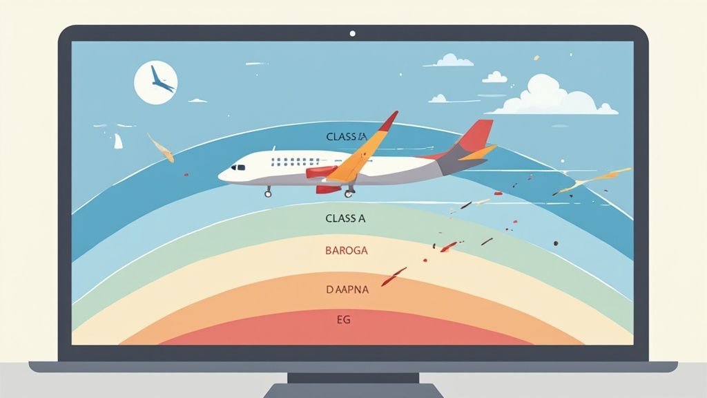
Class A Airspace: The High-Altitude Interstate
Picture an exclusive, high-speed superhighway reserved only for the fastest, most advanced traffic. That's essentially what Class A airspace is. It’s the highest layer of controlled airspace, so vast and uniform that it isn't even depicted on aeronautical charts. It simply exists everywhere at high altitudes.
This airspace starts at 18,000 feet Mean Sea Level (MSL) and stretches all the way up to Flight Level 600 (or 60,000 feet MSL). This is the domain of commercial airliners and business jets cruising on long-haul flights.
Flying here is serious business, with two non-negotiable rules.
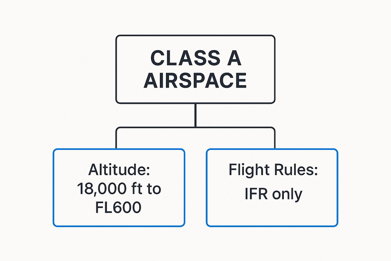
As the diagram shows, Class A is strictly for aircraft operating under Instrument Flight Rules (IFR). There's no "see and avoid" VFR flying up here. Every move is coordinated by Air Traffic Control (ATC).
To enter this elite airspace, a pilot must hold an instrument rating and be on an active IFR flight plan. The aircraft also needs the right gear: a two-way radio to talk to ATC and a Mode C transponder with ADS-B Out for constant radar surveillance.
Quick Guide to Controlled Airspace Requirements
To make sense of the different rules for each class, this table provides a quick side-by-side comparison. It's a handy cheat sheet for remembering what you need before you fly.
Airspace Class | Entry Requirement | Minimum Pilot Certificate | Two-Way Radio Required? | Transponder Required? |
|---|---|---|---|---|
Class A | IFR Clearance | Instrument Rating | Yes | Yes |
Class B | Explicit ATC Clearance | Private Pilot (or Student with endorsement) | Yes | Yes |
Class C | Two-Way Radio Communication | Student Pilot | Yes | Yes |
Class D | Two-Way Radio Communication | Student Pilot | Yes | No (usually) |
Class E | None for VFR | Student Pilot | No for VFR | Only above 10,000 ft |
This overview helps clarify the step-down in requirements as you move from the busiest airspace to the less complex, but still controlled, environments.
Class B Airspace: The Busiest Hubs
Dropping down from the stratosphere, we find ourselves in Class B airspace. If Class A is the national interstate, think of Class B as the massive, multi-lane ring road surrounding the downtown of a major metropolis. It’s custom-designed to protect the constant stream of traffic flowing into and out of the nation’s busiest airports, like Atlanta's Hartsfield-Jackson or Chicago O'Hare.
The shape of Class B is famously compared to an upside-down wedding cake. It’s built with multiple layers, or shelves, that get progressively wider as they go up, creating a protected funnel for aircraft on approach or departure.
Crucial Insight: To get into Class B airspace, you need more than just a friendly chat with ATC. You must get an explicit clearance. You're not legal until you hear the magic words: "You are cleared into the Class Bravo airspace."
These zones are absolutely vital. Though Class B airspace covers only about 0.2% of the sky over the U.S., it manages an astonishing 40% of all commercial flights. This system, a cornerstone of the FAA's role in aviation history since its formal creation in 1958, is what makes modern air travel possible.
Class C Airspace: The Moderately Busy Cities
Next up is Class C airspace, which is like the airspace around a mid-sized city's airport. It's definitely busy, but not on the same chaotic scale as a global hub. It adds a solid layer of safety and control without the intense entry rules of Class B. On sectional charts, you'll spot it by its solid magenta lines.
Class C has a much more standardized shape:
Inner Core: A circle with a 5-nautical-mile radius that extends from the surface up to 4,000 feet Above Ground Level (AGL).
Outer Shelf: A wider circle with a 10-nautical-mile radius that sits on top, starting at 1,200 feet AGL and also going up to 4,000 feet AGL.
Unlike Class B, you don't need a specific clearance to enter. However, you must establish and maintain two-way radio communication with ATC before you cross the boundary. Once a controller responds with your aircraft's call sign, you're good to go. Both a two-way radio and a Mode C transponder with ADS-B Out are required.
Class D Airspace: The Local Towns
Think of Class D airspace as a small town with a single traffic cop at its main intersection. It surrounds smaller airports that have an operating control tower but aren't busy enough to need a Class C or B designation. On a chart, it’s marked with a simple dashed blue line.
Its shape is usually a simple cylinder, typically about 4 nautical miles in radius and extending from the surface up to 2,500 feet AGL.
Entry is straightforward. Just like with Class C, you just need to establish two-way radio communication with the tower before you enter. There are no special pilot certificate requirements, but that two-way radio is a must-have. A transponder generally isn't required unless the Class D airspace happens to be underneath the 30-nautical-mile veil of a major Class B airport.
Class E Airspace: The "Everywhere Else" Airspace
Finally, we have Class E. This is the ultimate catch-all category. It’s essentially all the controlled airspace that isn't A, B, C, or D. It’s the "everywhere else" airspace, filling the gaps to provide a safe environment for IFR aircraft, especially as they transition between high-altitude routes and local airports. It is, by far, the most common type of controlled airspace.
Class E can start at a few different altitudes, which is what sometimes trips people up:
At the surface: Marked by dashed magenta lines, usually around airports that don't have an operating tower but still have instrument procedures.
At 700 feet AGL: Shown by a fuzzy, shaded magenta border. This creates a transition area around airports to protect IFR traffic descending for an approach.
At 1,200 feet AGL: This is the default floor for Class E across most of the country where nothing else is specified.
At 14,500 feet MSL: In most places, Class E extends up to (but doesn't include) the 18,000 feet MSL floor of Class A airspace.
For VFR pilots, Class E is the most relaxed of the controlled airspace classes. There are no specific entry procedures or equipment needed, though you will need a transponder with ADS-B Out if you fly above 10,000 feet MSL. Your main job is to maintain VFR weather minimums so you can "see and avoid" other planes, especially IFR traffic that might be popping out of the clouds.
Understanding the Freedom of Class G Airspace
After working our way through the structured, controlled layers of the sky, we finally get to the most wide-open part: Class G. If the other airspaces are the busy highways and city streets of aviation, think of Class G as the quiet country roads. This is where most recreational drone flights happen and where many private pilots go to just enjoy the pure freedom of flight.
Class G, also called Class Golf, is technically uncontrolled airspace. Now, this is probably one of the most misunderstood terms in the entire FAA system. "Uncontrolled" doesn't mean it's a lawless free-for-all with no rules. Far from it.
It simply means that Air Traffic Control (ATC) isn't actively separating aircraft. All that responsibility for maintaining safety and avoiding collisions lands squarely on the shoulders of the pilot in command. You are the one in charge.
Where You Find Class G Airspace
So, where is this aerial freedom found? Essentially, Class G is the airspace that's left over after all the controlled classes—A, B, C, D, and E—have been mapped out. It usually starts right at the ground and goes up until it bumps into the floor of the controlled airspace above it.
This means you’ll almost always find Class G in:
Remote and rural areas that are a good distance from any major airports.
The thin slice of air just underneath Class E airspace, which often starts at either 700 feet or 1,200 feet Above Ground Level (AGL).
For most drone pilots operating under the standard 400-foot AGL flight ceiling, your missions will almost entirely take place within Class G. But you can't get complacent. You must always check your sectional charts, because some Class E airspace extends all the way down to the surface, especially around smaller, non-towered airports.
The Rules of the Uncontrolled Road
Even though you don’t need to chat with ATC, you are absolutely required to follow specific Visual Flight Rules (VFR) for weather. These rules exist to make sure you can physically see other aircraft and keep a safe buffer from clouds, which might be hiding pilots flying on instruments.
In Class G airspace, the golden rule is “see and avoid.” Your eyes are your number one safety tool. It's your job to constantly scan the sky and be ready to maneuver away from any potential traffic, whether it's a crop duster, a hot air balloon, or another drone.
These requirements for visibility and cloud clearance vary based on your altitude and whether you’re flying during the day or at night. For most of us flying drones below 10,000 feet MSL during the day, the rule is straightforward: 1 statute mile of visibility and you must remain clear of clouds.
This is why situational awareness is so critical. Technology can give you a hand, and learning about the top [drone collision avoidance top systems for safer flights](https://www.jabdrone.com/post/drone-collision-avoidance-top-systems-for-safer-flights) can add a valuable layer of safety, particularly in areas where you might share the sky with manned aircraft.
Weather Minimums for Class G
Let's get specific with the VFR weather minimums. Knowing these is a fundamental part of flying safely in this airspace.
Altitude | Day Requirements | Night Requirements |
|---|---|---|
Below 1,200 ft AGL | 1 mile visibility, clear of clouds | 3 miles visibility, 500' below, 1000' above, 2000' horizontal from clouds |
Above 1,200 ft AGL but below 10,000 ft MSL | 1 mile visibility, 500' below, 1000' above, 2000' horizontal | 3 miles visibility, 500' below, 1000' above, 2000' horizontal |
Above 10,000 ft MSL | 5 miles visibility, 1000' below, 1000' above, 1 statute mile horizontal | 5 miles visibility, 1000' below, 1000' above, 1 statute mile horizontal |
As you can tell, the rules get much stricter at night and at higher altitudes. This is to compensate for lower natural visibility and the higher speeds of aircraft operating up there. Always, always run a thorough weather check during your pre-flight planning to be certain you can meet these minimums for your entire operation. Class G offers a lot of freedom, but that freedom comes with responsibility.
How to Handle Special Use Airspace Zones
So, you've got a handle on the A through G airspace classes. That's a huge step. But the sky has a few more tricks up its sleeve. Beyond those standard classifications, you’ll find zones that act like special districts with their own set of temporary or permanent rules that completely override the norm. This is what the FAA calls Special Use Airspace (SUA).
Think of SUA as areas where normal flight operations are restricted—or even outright banned—to protect both aircraft and crucial activities happening on the ground. Flying into one of these zones without doing your homework is a recipe for disaster. You could stumble into military training exercises or violate national security. Getting to know these areas is a non-negotiable part of safe flight planning.
Prohibited and Restricted Areas
Some chunks of the sky are complete no-go zones, while others are more like "ask for permission first" areas. These two are the most critical SUA types you absolutely must recognize on your charts.
Prohibited Areas (P-Areas) are exactly what they sound like. For national security reasons, flight is absolutely forbidden. You can't fly here. Period. On a chart, they're marked with a blue hatched border and a "P" followed by a number, like the infamous P-56 over Washington D.C. There’s no grey area; you must plan your route around them.
Restricted Areas (R-Areas) are a slight step down in severity but still require your full attention. These zones flag the presence of weird and often invisible hazards to aircraft—think artillery practice, aerial gunnery, or even guided missile tests. You can fly through a Restricted Area, but only after getting the green light from the agency in charge.
To get permission for a Restricted Area, you have to contact the controlling agency (which is usually ATC) and confirm the area is "cold," meaning it's not active. If it's "hot," you'll be denied entry and have to navigate around it. Never, ever assume one of these areas is inactive.
Zones for Military and Alert Activities
Other types of SUA exist to give you a heads-up about specific aerial activities so you can be on high alert. You can generally fly through these under VFR without needing special clearance, but it means you need to be paying extra close attention.
Military Operation Areas (MOAs): These are big blocks of airspace reserved for military training. We're talking aerobatics, air combat maneuvers, and seriously high-speed flight. MOAs are shown with a magenta hatched border. While it's legal to fly through an active MOA under VFR, you have to exercise extreme caution. It's always a smart move to contact ATC for traffic advisories before you even think about entering.
Alert Areas: You'll see these marked on charts to warn you about places with a lot of pilot training or other unusual aerial activity. Just like an MOA, you don't need permission to enter, but you should be extra vigilant. Think of it as the "student driver" zone of the sky.
Other Critical Chart Notations
Beyond the formally defined SUAs, a few other temporary advisories are just as important for your pre-flight check.
One of the most critical is the Temporary Flight Restriction (TFR). The FAA can create a TFR for all sorts of reasons, effectively setting up a short-term no-fly zone around major sporting events, natural disaster sites, or presidential movements. Because they're temporary, TFRs aren't printed on standard charts. This is a big deal. You are required to check for them during your pre-flight briefing using official FAA sources. Busting a TFR is a serious violation with heavy penalties.
By learning to spot these special zones and notes on your aeronautical charts, you're giving yourself the power to plan a route that's not just compliant, but genuinely safe. You'll steer clear of hidden dangers and set yourself up for a smooth flight from start to finish.
Airspace Rules Every Drone Pilot Must Know
If you're flying a Small Unmanned Aircraft System (sUAS), you're playing in the same sandbox as manned aircraft, but with your own set of rules. The FAA airspace classification system applies to all of us, but drones have a unique twist. While airplanes cruise at high altitudes, most of your drone operations will be much closer to the ground, which means you need to master a very specific slice of the sky.
For the vast majority of your flights, Class G airspace will be your home base. This is what's known as "uncontrolled" airspace. Since drone pilots are typically capped at 400 feet Above Ground Level (AGL), you'll spend most of your time here. Think of it as the quiet country roads of the sky—you don’t need to talk to Air Traffic Control (ATC). But with that freedom comes a huge responsibility: you must always see and avoid any other air traffic.
Things get more complicated when your flight plan takes you near an airport. That’s when knowing how to operate in controlled airspace becomes absolutely essential. Flying a drone in Class B, C, D, or the surface-level portions of Class E is strictly off-limits without getting the green light from the FAA first.
Getting Permission to Fly with LAANC
So, how do you get that permission? The key is a system called LAANC (Low Altitude Authorization and Notification Capability). This automated system is a total game-changer, acting as the digital handshake between drone pilots and ATC, granting near real-time authorization to fly in certain controlled airspace zones.
Using an FAA-approved LAANC provider—often built right into your favorite drone flight app—you can submit a request detailing where and how high you plan to fly. The system instantly checks your plan against the airport's pre-approved altitude maps, which look like a grid. If you're within the limits, you can get automated approval almost instantly.
Mastering this process is non-negotiable for any serious drone pilot. For a full rundown on getting certified, our guide on [drone license requirements](https://www.jabdrone.com/post/drone-license-requirements-your-quick-faa-guide) covers all the essential steps to get you started.
Interpreting Airspace on Drone Apps
Before you even think about taking off, your best friend is a flight planning app like the FAA’s own B4UFLY or another platform with LAANC built-in. These tools display all the complex airspace data on an interactive map, making it dead simple to see the rules for your exact flight location.
Here’s a quick guide to what you’ll see on the map:
Clear Areas: These are your go-zones. It means you’re in Class G airspace and can fly up to 400 feet AGL without needing any special authorization.
Grid Overlays: You'll see these grids over controlled airspace near airports. Each square has a number inside it (like 100, 200, or 400). That number is the maximum altitude in feet AGL that you can be approved to fly up to using LAANC in that specific spot.
Red "No-Fly" Zones: These areas, often right next to runways, are where LAANC is not available. To fly here, you would need to go through a much more complex manual authorization process directly with the FAA.
Remember this critical rule: The 400-foot AGL ceiling is your default limit under Part 107. But if you get LAANC authorization to fly in a controlled zone, your maximum altitude is whatever the grid map says—even if it's much lower than 400 feet. You must always fly at the lower of the two limits.
Understanding these drone-specific rules isn't just about checking a box for compliance. It's about being a responsible pilot and safely integrating your drone into the National Airspace System. When you master tools like LAANC and learn to read the maps, you can plan and fly with the confidence that you're operating both legally and safely.
Putting It All Together for Your Flight Plan
Knowing the theory behind each FAA airspace class is one thing. Actually using that knowledge to build a real-world flight plan is where your skills as a pilot truly begin to shine. This is the moment you translate abstract rules into concrete actions, making sure every single flight is safe and compliant.
It all starts with learning to read the language of the sky: aeronautical charts.
Think of Sectional and VFR Terminal Area Charts as your detailed roadmaps. The colors, lines, and numbers aren't just random squiggles—they're specific instructions. That solid blue line? That’s marking the complex, multi-layered Class B airspace. Solid magenta lines define the simpler Class C zones. You'll see dashed blue lines when a Class D tower is nearby, and that fuzzy magenta shading tells you Class E airspace starts at 700 feet above the ground.
Your Pre-Flight Briefing Checklist
Before any flight, a solid pre-flight briefing is non-negotiable. This is your final safety net, designed to catch any temporary hazards or changes that aren't printed on your charts. Using official FAA resources or a quality flight app is absolutely critical here.
Your pre-flight check has to include:
Checking for NOTAMs: Notices to Air Missions give you real-time updates on things like runway closures, unlit obstacles, or other airport issues.
Identifying TFRs: Temporary Flight Restrictions can pop up suddenly for major events, emergencies, or VIP movements. Flying into one is a serious mistake.
Reviewing SUAs: You need to confirm if any Special Use Airspace, like a Military Operation Area (MOA), will be "hot" or active during your planned flight time.
A successful flight isn't just about a smooth takeoff and landing. It's about the diligent prep work you do on the ground. A thorough pre-flight check shows you're a responsible member of the aviation community.
Finalizing Your Plan with Confidence
Once you've studied your charts and run through your briefing, you can finally build your route with confidence. You’ll know the right altitudes to fly, which communication frequencies to monitor, and exactly where you need to get clearance from ATC. This process eliminates guesswork and replaces it with certainty.
For drone pilots, this is also the time to double-check that your drone's registration is up-to-date. If you need a refresher on getting that handled, you can follow our simple [FAA drone registration quick guide](https://www.jabdrone.com/post/faa-drone-registration-quick-guide).
By making these steps a routine part of every flight plan, you're not just following the rules—you're mastering the art of safe navigation in the national airspace.
Frequently Asked Questions About Airspace
Even after you've got the basics down, some practical questions always seem to pop up in the field. Let's tackle some of the most common points of confusion for drone pilots, whether you're just starting out or have been flying for years.
What Is the Difference Between MSL and AGL?
This is one of the most fundamental concepts in all of aviation, and getting it wrong can have serious consequences. MSL stands for Mean Sea Level, which is your true altitude measured from the average level of the sea. All elevations on aeronautical charts are given in MSL.
On the other hand, AGL means Above Ground Level—your height directly above the terrain right under your drone. The distinction is critical. For example, a drone pilot flying at the legal limit of 400 feet AGL over a 1,000-foot tall plateau is actually operating at 1,400 feet MSL. That's a huge difference and something you always need to account for.
How Can I Tell What Airspace I Am In?
Back in the day, you'd have to pore over a paper sectional chart. While those skills are still valuable, today's technology gives us instant answers. Apps designed for drone pilots, like the FAA's own B4UFLY, show your real-time position on a map layered with all the necessary airspace data.
But a word of caution: Relying only on an app without knowing how to read a chart is a risky habit. The best pilots use technology as their primary tool but maintain the skills to use a chart as a reliable backup when things go wrong.
What Is a Common Airspace Mistake to Avoid?
One of the most frequent and dangerous errors a pilot can make is an airspace bust, officially called a pilot deviation. This happens when you fly into controlled airspace—especially the busy Class B, C, or D zones around airports—without getting the required clearance from Air Traffic Control.
These aren't just minor slip-ups; they can create serious conflicts with manned aircraft. Diligent flight planning and constant situational awareness are your best defenses. It’s also vital to stay on top of regulatory updates. To make sure you’re current, check out our guide on [understanding the FAA Reauthorization Act of 2024](https://www.jabdrone.com/post/understanding-the-faa-reauthorization-act-of-2024-essential-insights-for-drone-pilots).
At JAB Drone, we're committed to providing the expert insights you need to fly safely and confidently. Explore our comprehensive reviews and guides at https://www.jabdrone.com.
Comments